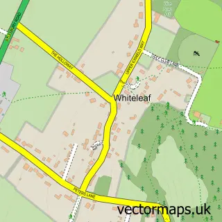
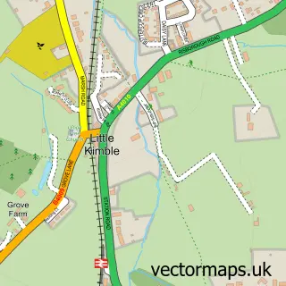
This Monks Risborough street map is a detailed vector street map covering a 750m x 750m area. Select a larger area to create and download your own vector street map of Monks Risborough.
The 750-metre map sample for Monks Risborough covers 236 mapped buildings and approximately 21.4 km of road detail, of which 17 named roads are named. The immediate area includes 1 school, 2 GP surgeries within 2 miles and 4 MOT stations within 2 miles. The wider area around Monks Risborough features 2 tourism points of interest and 1 food and drink venue. To create a larger or custom map of Monks Risborough, the map builder lets you define your own coverage area and download editable SVG, PDF and PNG files.
Create a larger editable map of Monks Risborough
Choose any area you need and generate a high-quality vector map instantly. Perfect for print, planning, design, business and personal use.

This Monks Risborough street map in Buckinghamshire is available as downloadable SVG, PDF and PNG map files, or as a printed map for planning, business, display, education, local information and design work. You can also create a larger custom map area using the map selector.
What this Monks Risborough map sample shows
Monks Risborough lies within Princes Risborough Cp parish, part of The Risboroughs ward in the Buckinghamshire local authority area. The postcode geography for this area includes the HP postcode area, the HP27 postcode district and the HP27 9 postcode sector. Residents fall under the Nhs Buckinghamshire, Oxfordshire And Berkshire West Integrated Care Board for NHS services.
Local features near Monks Risborough
Within 2 milesAmenities and services in and around Monks Risborough.
Administrative and postcode information for Monks Risborough
The local authority covering Monks Risborough is Buckinghamshire, within the county of Buckinghamshire. The settlement lies within The Risboroughs ward and Princes Risborough Cp civil parish. The HP27 postcode district and HP27 9 postcode sector serve the immediate area. NHS provision in the area is delivered through Buckinghamshire Healthcare Nhs Trust.
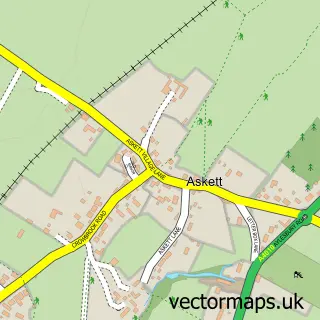
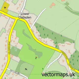
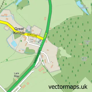
Nearby street map samples around Monks Risborough


More street maps in Buckinghamshire
750 metre map area coverage
Boundary, postcode and point of interest information for the 750m x 750m rectangle centred on this sample map.
Boundaries containing map centre
Constituency: Mid Buckinghamshire Co Const
District: Buckinghamshire
Icb: NHS Thames Valley ICB
Parish: Princes Risborough CP
Police Force: thames valley
Postcode District: HP27
Postcode Sector: HP27 9
Ward: Princes Risborough Ward
Nearby boundaries intersecting sample
Postcode Sector: HP27 0
Postcode coverage
POI category counts
Arts And Crafts: 1
Auto Loan Provider: 1
Automotive Repair: 1
Automotive Services And Repair: 1
Business Consulting: 1
Chicken Restaurant: 1
Chinese Restaurant: 1
Church Cathedral: 1
Community Services Non Profits: 1
Convenience Store: 1
Sample points of interest
- Meadowcroft Pottery
- Log Book Loans
- Grahams Garage Services
- Healthwatch Bucks
- Shoodan
- Favorite Chicken & Ribs Princes Risborough
- Wonder Wok
- St Dunstan's Church
- Bucks Oil Buying Club
- Londis Londis - Farm Way
- Apt Aerials
- Monks Risborough C of E Primary School
Create a larger editable map of Monks Risborough
This sample shows only a 750 metre area. To create a larger map of Monks Risborough, use our map builder to choose your own coverage area, add titles and download editable SVG, PDF and PNG files.
Create a custom map of Monks Risborough