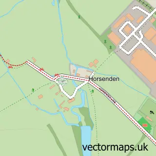
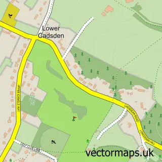
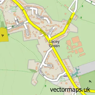
This Princes Risborough street map is a detailed vector street map covering a 750m x 750m area. Select a larger area to create and download your own vector street map of Princes Risborough.
The 750-metre map sample for Princes Risborough covers 419 mapped buildings and approximately 30.6 km of road detail, of which 41 named roads are named. The immediate area includes 1 school, 2 GP surgeries, 5 pubs and 2 MOT stations, with 4 within 2 miles. The wider area around Princes Risborough features 1 tourism point of interest and 10 food and drink venues. To create a larger or custom map of Princes Risborough, the map builder lets you define your own coverage area and download editable SVG, PDF and PNG files.
Create a larger editable map of Princes Risborough
Choose any area you need and generate a high-quality vector map instantly. Perfect for print, planning, design, business and personal use.

This Princes Risborough street map in Buckinghamshire is available as downloadable SVG, PDF and PNG map files, or as a printed map for planning, business, display, education, local information and design work. You can also create a larger custom map area using the map selector.
What this Princes Risborough map sample shows
Princes Risborough lies within Princes Risborough Cp parish, part of The Risboroughs ward in the Buckinghamshire local authority area. The postcode geography for this area includes the HP postcode area, the HP27 postcode district and the HP27 0 postcode sector. Residents fall under the Nhs Buckinghamshire, Oxfordshire And Berkshire West Integrated Care Board for NHS services.
Local features near Princes Risborough
Within 2 milesAmenities and services in and around Princes Risborough.
Administrative and postcode information for Princes Risborough
Princes Risborough lies within Princes Risborough Cp parish, part of The Risboroughs ward in the Buckinghamshire local authority area. The postcode geography for this area includes the HP postcode area, the HP27 postcode district and the HP27 0 postcode sector. Residents fall under the Nhs Buckinghamshire, Oxfordshire And Berkshire West Integrated Care Board for NHS services.
Nearby street map samples around Princes Risborough

More street maps in Buckinghamshire
750 metre map area coverage
Boundary, postcode and point of interest information for the 750m x 750m rectangle centred on this sample map.
Boundaries containing map centre
Constituency: Mid Buckinghamshire Co Const
District: Buckinghamshire
Icb: NHS Thames Valley ICB
Parish: Princes Risborough CP
Police Force: thames valley
Postcode District: HP27
Postcode Sector: HP27 0
Ward: Princes Risborough Ward
Nearby boundaries intersecting sample
Postcode Sector: HP27 9
Postcode coverage
POI category counts
Real Estate Agent: 10
Flowers And Gifts Shop: 8
Automotive Repair: 6
Barber: 6
Convenience Store: 6
Professional Services: 6
Dentist: 5
Pub: 5
Advertising Agency: 4
Beauty Salon: 4
Sample points of interest
- Rhiannon Griffiths, BSc Lic Ac
- Eyes Wide Open
- Pharmaceutical Management Intelligence
- Threefold Media
- Verde Design & Print
- Crystal Serenity
- Iain Rennie Hospice Shop
- Domestic Appliances Ltd
- Cast Iron Range Cookers
- Cymbeline
- Art & Office
- Risborough & District Mrc
Create a larger editable map of Princes Risborough
This sample shows only a 750 metre area. To create a larger map of Princes Risborough, use our map builder to choose your own coverage area, add titles and download editable SVG, PDF and PNG files.
Create a custom map of Princes Risborough