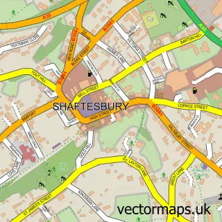
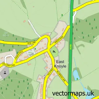
This Motcombe street map is a detailed vector street map covering a 750m x 750m area. Select a larger area to create and download your own vector street map of Motcombe.
The 750-metre map sample for Motcombe covers 138 mapped buildings and approximately 5.4 km of road detail, of which 3 named roads are named. The immediate area includes 1 school and 1 MOT station, with 6 within 2 miles. The wider area around Motcombe features 2 campsites within 2 miles. To create a larger or custom map of Motcombe, the map builder lets you define your own coverage area and download editable SVG, PDF and PNG files.
Create a larger editable map of Motcombe
Choose any area you need and generate a high-quality vector map instantly. Perfect for print, planning, design, business and personal use.

This Motcombe street map in Dorset is available as downloadable SVG, PDF and PNG map files, or as a printed map for planning, business, display, education, local information and design work. You can also create a larger custom map area using the map selector.
What this Motcombe map sample shows
Motcombe lies within Motcombe Cp parish, part of Gillingham ward in the Dorset local authority area. The postcode geography for this area includes the SP postcode area, the SP7 postcode district and the SP7 9 postcode sector. Residents fall under the Nhs Dorset Integrated Care Board for NHS services.
Local features near Motcombe
Within 2 milesAmenities and services in and around Motcombe.
Administrative and postcode information for Motcombe
Motcombe lies within Motcombe Cp parish, part of Gillingham ward in the Dorset local authority area. The postcode geography for this area includes the SP postcode area, the SP7 postcode district and the SP7 9 postcode sector. Residents fall under the Nhs Dorset Integrated Care Board for NHS services.
Nearby street map samples around Motcombe

More street maps in Dorset
750 metre map area coverage
Boundary, postcode and point of interest information for the 750m x 750m rectangle centred on this sample map.
Boundaries containing map centre
Constituency: North Dorset Co Const
District: Dorset
Icb: NHS Dorset ICB
Parish: Motcombe CP
Police Force: dorset
Postcode District: SP7
Postcode Sector: SP7 9
Ward: Gillingham Ward
Nearby boundaries intersecting sample
No additional intersecting boundaries found.
Postcode coverage
POI category counts
Anglican Church: 2
Building Contractor: 1
Building Supply Store: 1
Cooking School: 1
Elementary School: 1
Farm: 1
Martial Arts Club: 1
Retail: 1
Scout Hall: 1
Taxi Service: 1
Sample points of interest
- Motcombe: St Mary
- St Mary's Church
- Prosser Building Services Ltd.
- Loosehanger Oak
- Laura Pope
- Motcombe CE Primary School
- Sorelle
- The Warrior Academy - Motcombe Martial Arts
- Art in Metal
- Motcombe
- Stag Taxis
- Motcombe Memorial Hall
Create a larger editable map of Motcombe
This sample shows only a 750 metre area. To create a larger map of Motcombe, use our map builder to choose your own coverage area, add titles and download editable SVG, PDF and PNG files.
Create a custom map of Motcombe