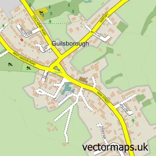
This Naseby street map is a detailed vector street map covering a 750m x 750m area. Select a larger area to create and download your own vector street map of Naseby.
The 750-metre map sample for Naseby covers 209 mapped buildings and approximately 20.9 km of road detail, of which 13 named roads are named. The immediate area includes 1 school and 2 pubs. The wider area around Naseby features 1 tourism point of interest and 2 food and drink venues. To create a larger or custom map of Naseby, the map builder lets you define your own coverage area and download editable SVG, PDF and PNG files.
Create a larger editable map of Naseby
Choose any area you need and generate a high-quality vector map instantly. Perfect for print, planning, design, business and personal use.

This Naseby street map in Northamptonshire is available as downloadable SVG, PDF and PNG map files, or as a printed map for planning, business, display, education, local information and design work. You can also create a larger custom map area using the map selector.
What this Naseby map sample shows
Naseby lies within Naseby Cp parish, part of Welford ward in the West Northamptonshire local authority area. The postcode geography for this area includes the NN postcode area, the NN6 postcode district and the NN6 6 postcode sector. Residents fall under the Nhs Northamptonshire Integrated Care Board for NHS services.
Local features near Naseby
Within 2 milesAmenities and services in and around Naseby.
Administrative and postcode information for Naseby
Naseby lies within Naseby Cp parish, part of Welford ward in the West Northamptonshire local authority area. The postcode geography for this area includes the NN postcode area, the NN6 postcode district and the NN6 6 postcode sector. Residents fall under the Nhs Northamptonshire Integrated Care Board for NHS services.
Nearby street map samples around Naseby

More street maps in Northamptonshire
750 metre map area coverage
Boundary, postcode and point of interest information for the 750m x 750m rectangle centred on this sample map.
Boundaries containing map centre
Constituency: Daventry Co Const
District: West Northamptonshire
Icb: NHS Northamptonshire ICB
Parish: Naseby CP
Police Force: northamptonshire
Postcode District: NN6
Postcode Sector: NN6 6
Ward: Naseby Ward
Nearby boundaries intersecting sample
No additional intersecting boundaries found.
Postcode coverage
POI category counts
Elementary School: 2
Pub: 2
Advertising Agency: 1
Anglican Church: 1
Bed And Breakfast: 1
Business Consulting: 1
Church Cathedral: 1
Clothing Store: 1
Convenience Store: 1
Flowers And Gifts Shop: 1
Sample points of interest
- 2112 Marketing
- All Saints, Naseby
- The Old Post House
- EPC Network
- All Saints Church
- Roma Leather
- One Stop
- Naseby Church of England Primary School
- Naseby Church of England Primary School
- Farmhouse Flowers Naseby
- Fairfaxs Farm
- Medical Export Co
Create a larger editable map of Naseby
This sample shows only a 750 metre area. To create a larger map of Naseby, use our map builder to choose your own coverage area, add titles and download editable SVG, PDF and PNG files.
Create a custom map of Naseby