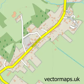
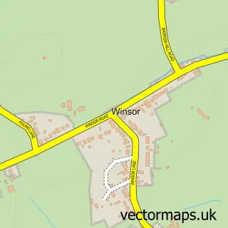
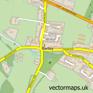
This Netley Marsh street map is a detailed vector street map covering a 750m x 750m area. Select a larger area to create and download your own vector street map of Netley Marsh.
The 750-metre map sample for Netley Marsh covers 151 mapped buildings and approximately 5.7 km of road detail, of which 3 named roads are named. The immediate area includes 1 school, 2 GP surgeries within 2 miles, 2 pubs and 10 MOT stations within 2 miles. The wider area around Netley Marsh features 2 food and drink venues, 1 hotel and 2 campsites within 2 miles. To create a larger or custom map of Netley Marsh, the map builder lets you define your own coverage area and download editable SVG, PDF and PNG files.
Create a larger editable map of Netley Marsh
Choose any area you need and generate a high-quality vector map instantly. Perfect for print, planning, design, business and personal use.

This Netley Marsh street map in Hampshire is available as downloadable SVG, PDF and PNG map files, or as a printed map for planning, business, display, education, local information and design work. You can also create a larger custom map area using the map selector.
What this Netley Marsh map sample shows
Netley Marsh lies within Netley Marsh Cp parish, part of Ashurst, Copythorne South And Netley Marsh ward in the New Forest District local authority area. The postcode geography for this area includes the SO postcode area, the SO40 postcode district and the SO40 7 postcode sector. Residents fall under the Nhs Hampshire And Isle Of Wight Integrated Care Board for NHS services.
Local features near Netley Marsh
Within 2 milesAmenities and services in and around Netley Marsh.
Administrative and postcode information for Netley Marsh
The local authority covering Netley Marsh is New Forest District, within the county of Hampshire. The settlement lies within Ashurst, Copythorne South And Netley Marsh ward and Netley Marsh Cp civil parish. The SO40 postcode district and SO40 7 postcode sector serve the immediate area. NHS provision in the area is delivered through University Hospital Southampton Nhs Foundation Trust.
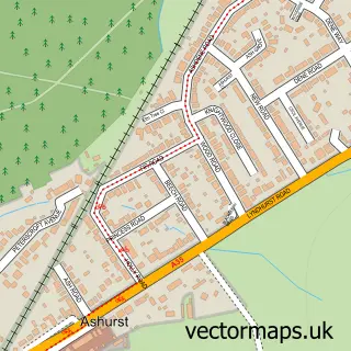
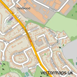
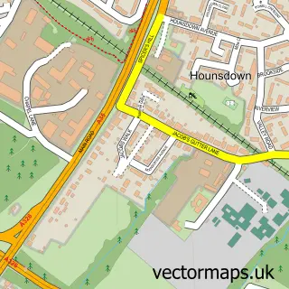
Nearby street map samples around Netley Marsh

More street maps in Hampshire
750 metre map area coverage
Boundary, postcode and point of interest information for the 750m x 750m rectangle centred on this sample map.
Boundaries containing map centre
Constituency: New Forest East Co Const
County: Hampshire County
District: New Forest District
Icb: NHS Hampshire and Isle of Wight ICB
Parish: Netley Marsh CP
Police Force: hampshire
Postcode District: SO40
Postcode Sector: SO40 7
Ward: Ashurst, Bramshaw, Copythorne & Netley Marsh Ward
Nearby boundaries intersecting sample
Parish: Totton and Eling CP
Postcode Sector: SO40 2, SO40 8
Ward: Totton North Ward
Postcode coverage
POI category counts
Building Supply Store: 2
Home Service: 2
Pub: 2
Retirement Home: 2
Anglican Church: 1
Arts And Entertainment: 1
Bridal Shop: 1
Business Management Services: 1
Car Wash: 1
Carpet Store: 1
Sample points of interest
- St Matthews
- Netley Marsh Steam & Craft Show
- Hair and Makeup by Katie Louise
- Lightning Electrical Construction
- M Lewis Contract
- Tools For Self Reliance
- Hand Car Wash
- DW Carpets & Flooring - Totton
- Tools for Self Reliance
- Windward Day Services
- Solent Water Treatment
- African Activities
Create a larger editable map of Netley Marsh
This sample shows only a 750 metre area. To create a larger map of Netley Marsh, use our map builder to choose your own coverage area, add titles and download editable SVG, PDF and PNG files.
Create a custom map of Netley Marsh