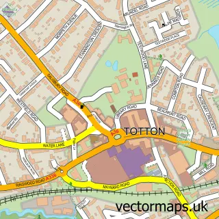
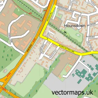
This Testwood street map is a detailed vector street map covering a 750m x 750m area. Select a larger area to create and download your own vector street map of Testwood.
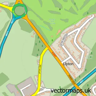
The 750-metre map sample for Testwood covers 536 mapped buildings and approximately 12.6 km of road detail, of which 22 named roads are named. The immediate area includes 1 school, 2 GP surgeries within 2 miles, 2 pubs and 18 MOT stations within 2 miles. The wider area around Testwood features 2 tourism points of interest and 3 food and drink venues. To create a larger or custom map of Testwood, the map builder lets you define your own coverage area and download editable SVG, PDF and PNG files.
Create a larger editable map of Testwood
Choose any area you need and generate a high-quality vector map instantly. Perfect for print, planning, design, business and personal use.

This Testwood street map in Hampshire is available as downloadable SVG, PDF and PNG map files, or as a printed map for planning, business, display, education, local information and design work. You can also create a larger custom map area using the map selector.
What this Testwood map sample shows
Testwood lies within Totton And Eling Cp parish, part of Totton East ward in the New Forest District local authority area. The postcode geography for this area includes the SO postcode area, the SO40 postcode district and the SO40 3 postcode sector. Residents fall under the Nhs Hampshire And Isle Of Wight Integrated Care Board for NHS services.
Local features near Testwood
Within 2 milesAmenities and services in and around Testwood.
Administrative and postcode information for Testwood
Testwood lies within Totton And Eling Cp parish, part of Totton East ward in the New Forest District local authority area. The postcode geography for this area includes the SO postcode area, the SO40 postcode district and the SO40 3 postcode sector. Residents fall under the Nhs Hampshire And Isle Of Wight Integrated Care Board for NHS services.
Nearby street map samples around Testwood

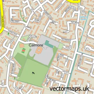
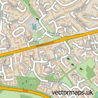
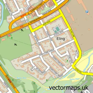
More street maps in Hampshire
750 metre map area coverage
Boundary, postcode and point of interest information for the 750m x 750m rectangle centred on this sample map.
Boundaries containing map centre
Constituency: New Forest East Co Const
County: Hampshire County
District: New Forest District
Icb: NHS Hampshire and Isle of Wight ICB
Parish: Totton and Eling CP
Police Force: hampshire
Postcode District: SO40
Postcode Sector: SO40 3
Ward: Totton Central Ward
Nearby boundaries intersecting sample
Postcode Sector: SO40 2
Ward: Totton North Ward
Postcode coverage
POI category counts
Building Supply Store: 5
Beauty Salon: 4
Industrial Equipment: 4
Contractor: 3
Retail: 3
Automotive Repair: 2
Beauty And Spa: 2
Elementary School: 2
Food Beverage Service Distribution: 2
Hospital: 2
Sample points of interest
- Graphics Hub
- Oaktree Cattery
- Challenger Trophies & Awards
- The Cooperative Food (BF) Totton - Salisbury Road (ERF), Totton
- Harwoods Accident Repair Centre
- EMS Parts Ltd. Southampton
- J S R Autoservices
- L&A Mechanics Ltd
- Testwood Baptist Church
- Krazy Cutzz
- LOX by lizzie
- Nails By Niky
Create a larger editable map of Testwood
This sample shows only a 750 metre area. To create a larger map of Testwood, use our map builder to choose your own coverage area, add titles and download editable SVG, PDF and PNG files.
Create a custom map of Testwood