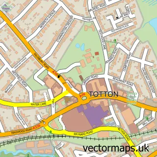
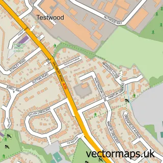
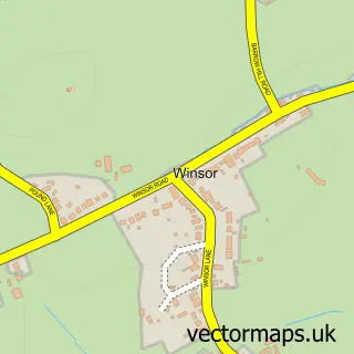
This West Totton street map is a detailed vector street map covering a 750m x 750m area. Select a larger area to create and download your own vector street map of West Totton.
The 750-metre map sample for West Totton covers 526 mapped buildings and approximately 21.0 km of road detail, of which 54 named roads are named. The immediate area includes 1 school, 1 GP surgery, with 2 within 2 miles and 12 MOT stations within 2 miles. The wider area around West Totton features 1 food and drink venue and 1 campsite within 2 miles. To create a larger or custom map of West Totton, the map builder lets you define your own coverage area and download editable SVG, PDF and PNG files.
Create a larger editable map of West Totton
Choose any area you need and generate a high-quality vector map instantly. Perfect for print, planning, design, business and personal use.

This West Totton street map in Hampshire is available as downloadable SVG, PDF and PNG map files, or as a printed map for planning, business, display, education, local information and design work. You can also create a larger custom map area using the map selector.
What this West Totton map sample shows
West Totton lies within Netley Marsh Cp parish, part of Ashurst, Copythorne South And Netley Marsh ward in the New Forest District local authority area. The postcode geography for this area includes the SO postcode area, the SO40 postcode district and the SO40 7 postcode sector. Residents fall under the Nhs Hampshire And Isle Of Wight Integrated Care Board for NHS services.
Local features near West Totton
Within 2 milesAmenities and services in and around West Totton.
Administrative and postcode information for West Totton
The local authority covering West Totton is New Forest District, within the county of Hampshire. The settlement lies within Ashurst, Copythorne South And Netley Marsh ward and Netley Marsh Cp civil parish. The SO40 postcode district and SO40 7 postcode sector serve the immediate area. NHS provision in the area is delivered through University Hospital Southampton Nhs Foundation Trust.
Nearby street map samples around West Totton

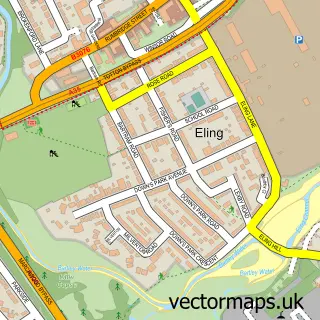
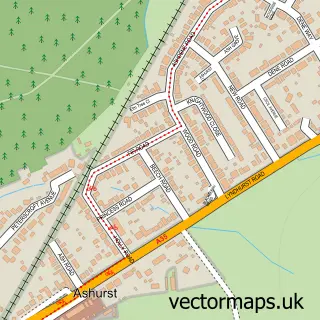
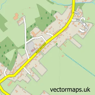
More street maps in Hampshire
750 metre map area coverage
Boundary, postcode and point of interest information for the 750m x 750m rectangle centred on this sample map.
Boundaries containing map centre
Constituency: New Forest East Co Const
County: Hampshire County
District: New Forest District
Icb: NHS Hampshire and Isle of Wight ICB
Parish: Totton and Eling CP
Police Force: hampshire
Postcode District: SO40
Postcode Sector: SO40 8
Ward: Totton South Ward
Nearby boundaries intersecting sample
Parish: Netley Marsh CP
Postcode Sector: SO40 7
Ward: Ashurst, Bramshaw, Copythorne & Netley Marsh Ward, Totton North Ward
Postcode coverage
POI category counts
Doctor: 3
Community Center: 2
Dentist: 2
Flowers And Gifts Shop: 2
Gift Shop: 2
Hair Salon: 2
Pharmacy: 2
Preschool: 2
Shopping Center: 2
Alternative Medicine: 1
Sample points of interest
- Robert Allen Associates
- Solex UK
- Hair Talk
- Cinderella Beauty Therapy
- Delectable Digits
- Aztec Fascias Ltd.
- so40 Cafe Bar
- Ming's Chinese Takeaway
- Trinity Church
- Lyndhurst Community Centre
- West Totton Community Centre
- Tesco Express
Create a larger editable map of West Totton
This sample shows only a 750 metre area. To create a larger map of West Totton, use our map builder to choose your own coverage area, add titles and download editable SVG, PDF and PNG files.
Create a custom map of West Totton