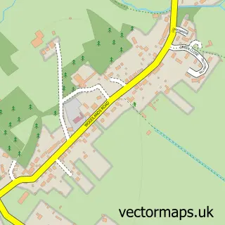
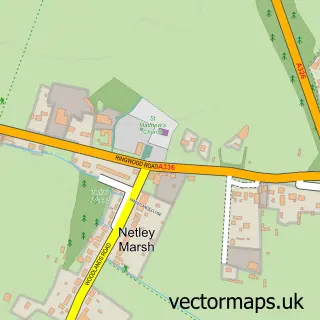
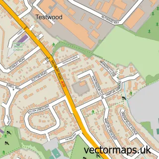
This Ashurst street map is a detailed vector street map covering a 750m x 750m area. Select a larger area to create and download your own vector street map of Ashurst.
The 750-metre map sample for Ashurst covers 438 mapped buildings and approximately 10.7 km of road detail, of which 21 named roads are named. The immediate area includes 1 GP surgery within 2 miles, 1 pub and 3 MOT stations within 2 miles. The wider area around Ashurst features 1 tourism point of interest, 4 food and drink venues and 1 hotel. To create a larger or custom map of Ashurst, the map builder lets you define your own coverage area and download editable SVG, PDF and PNG files.
Create a larger editable map of Ashurst
Choose any area you need and generate a high-quality vector map instantly. Perfect for print, planning, design, business and personal use.

This Ashurst street map in Hampshire is available as downloadable SVG, PDF and PNG map files, or as a printed map for planning, business, display, education, local information and design work. You can also create a larger custom map area using the map selector.
What this Ashurst map sample shows
Ashurst lies within Ashurst And Colbury Cp parish, part of Ashurst, Copythorne South And Netley Marsh ward in the New Forest District local authority area. The postcode geography for this area includes the SO postcode area, the SO40 postcode district and the SO40 7 postcode sector. Residents fall under the Nhs Hampshire And Isle Of Wight Integrated Care Board for NHS services.
Local features near Ashurst
Within 2 milesAmenities and services in and around Ashurst.
Administrative and postcode information for Ashurst
The local authority covering Ashurst is New Forest District, within the county of Hampshire. The settlement lies within Ashurst, Copythorne South And Netley Marsh ward and Ashurst And Colbury Cp civil parish. The SO40 postcode district and SO40 7 postcode sector serve the immediate area. NHS provision in the area is delivered through University Hospital Southampton Nhs Foundation Trust.
Nearby street map samples around Ashurst

More street maps in Hampshire
750 metre map area coverage
Boundary, postcode and point of interest information for the 750m x 750m rectangle centred on this sample map.
Boundaries containing map centre
Constituency: New Forest East Co Const
County: Hampshire County
District: New Forest District
Icb: NHS Hampshire and Isle of Wight ICB
Parish: Ashurst and Colbury CP
Police Force: hampshire
Postcode District: SO40
Postcode Sector: SO40 7
Ward: Ashurst, Bramshaw, Copythorne & Netley Marsh Ward
Nearby boundaries intersecting sample
Parish: Denny Lodge CP, Netley Marsh CP
Ward: Brockenhurst & Denny Lodge Ward
Postcode coverage
POI category counts
Assisted Living Facility: 4
Beauty Salon: 3
Building Supply Store: 2
Cafe: 2
Chiropractor: 2
Convenience Store: 2
Veterinarian: 2
Architectural Designer: 1
Armed Forces Branch: 1
Atms: 1
Sample points of interest
- ACM Architects Ltd
- First Ashurst and Lyndhurst
- Beech Court
- Caring Homes Group
- Oak Tree Lodge
- Oakleaf Lodge
- The Southern Co-Operative Ashurst , Ashurst
- Southern Sewing & Upholstery Services
- Ultimate in Car
- Asha
- Wannabe-pampered
- Beautiful you - Ashurst
Create a larger editable map of Ashurst
This sample shows only a 750 metre area. To create a larger map of Ashurst, use our map builder to choose your own coverage area, add titles and download editable SVG, PDF and PNG files.
Create a custom map of Ashurst