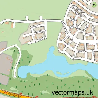
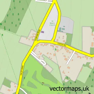
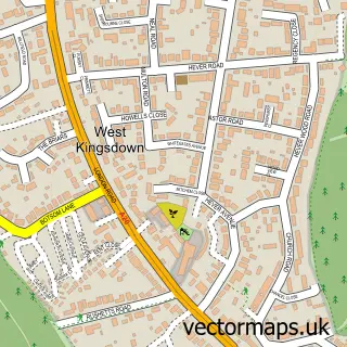
This New Ash Green street map is a detailed vector street map covering a 750m x 750m area. Select a larger area to create and download your own vector street map of New Ash Green.
The 750-metre map sample for New Ash Green covers 327 mapped buildings and approximately 14.8 km of road detail, of which 9 named roads are named. The immediate area includes 1 school, 3 pubs and 3 MOT stations within 2 miles. The wider area around New Ash Green features 4 food and drink venues. To create a larger or custom map of New Ash Green, the map builder lets you define your own coverage area and download editable SVG, PDF and PNG files.
Create a larger editable map of New Ash Green
Choose any area you need and generate a high-quality vector map instantly. Perfect for print, planning, design, business and personal use.

This New Ash Green street map in Kent is available as downloadable SVG, PDF and PNG map files, or as a printed map for planning, business, display, education, local information and design work. You can also create a larger custom map area using the map selector.
What this New Ash Green map sample shows
New Ash Green lies within Ash-Cum-Ridley Cp parish, part of Ash And New Ash Green ward in the Sevenoaks District local authority area. The postcode geography for this area includes the DA postcode area, the DA3 postcode district and the DA3 8 postcode sector. Residents fall under the Nhs Kent And Medway Integrated Care Board for NHS services.
Local features near New Ash Green
Within 2 milesAmenities and services in and around New Ash Green.
Administrative and postcode information for New Ash Green
The local authority covering New Ash Green is Sevenoaks District, within the county of Kent. The settlement lies within Ash And New Ash Green ward and Ash-Cum-Ridley Cp civil parish. The DA3 postcode district and DA3 8 postcode sector serve the immediate area. NHS provision in the area is delivered through Dartford And Gravesham Nhs Trust.
Nearby street map samples around New Ash Green

More street maps in Kent
750 metre map area coverage
Boundary, postcode and point of interest information for the 750m x 750m rectangle centred on this sample map.
Boundaries containing map centre
Constituency: Tonbridge Co Const
County: Kent County
District: Sevenoaks District
Icb: NHS Kent and Medway ICB
Parish: Ash-cum-Ridley CP
Police Force: kent
Postcode District: DA3
Postcode Sector: DA3 8
Ward: Ash and New Ash Green Ward
Nearby boundaries intersecting sample
Postcode District: TN15
Postcode Sector: TN15 7
Postcode coverage
POI category counts
Building Supply Store: 7
Bakery: 3
Preschool: 3
Pub: 3
Real Estate Agent: 3
Assisted Living Facility: 2
Beauty And Spa: 2
Beauty Salon: 2
Cleaning Services: 2
Convenience Store: 2
Sample points of interest
- Sylvera Dance School
- Hilite Direct Marketing Services
- Panel Agency
- BTH Consulting
- Sommer Design
- Spice Village, New Ash Green
- Anchor - Turners Oak
- Hanover Place - Anchor
- Morrisons Daily - New Ash Green, New Ash Green
- London Coins
- The Granary
- The Village Bakery
Create a larger editable map of New Ash Green
This sample shows only a 750 metre area. To create a larger map of New Ash Green, use our map builder to choose your own coverage area, add titles and download editable SVG, PDF and PNG files.
Create a custom map of New Ash Green