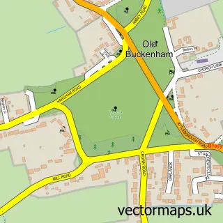
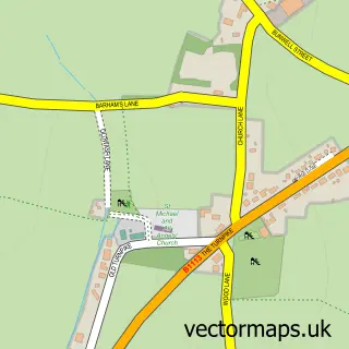
This New Buckenham street map is a detailed vector street map covering a 750m x 750m area. Select a larger area to create and download your own vector street map of New Buckenham.
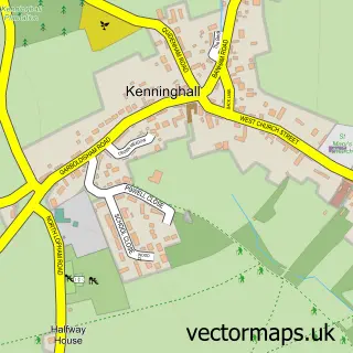
The 750-metre map sample for New Buckenham covers 165 mapped buildings and approximately 11.9 km of road detail, of which 12 named roads are named. The immediate area includes 1 pub and 2 MOT stations within 2 miles. The wider area around New Buckenham features 2 food and drink venues and 1 hotel. To create a larger or custom map of New Buckenham, the map builder lets you define your own coverage area and download editable SVG, PDF and PNG files.
Create a larger editable map of New Buckenham
Choose any area you need and generate a high-quality vector map instantly. Perfect for print, planning, design, business and personal use.

This New Buckenham street map in Norfolk is available as downloadable SVG, PDF and PNG map files, or as a printed map for planning, business, display, education, local information and design work. You can also create a larger custom map area using the map selector.
What this New Buckenham map sample shows
New Buckenham lies within New Buckenham Cp parish, part of The Buckenhams & Banham ward in the Breckland District local authority area. The postcode geography for this area includes the NR postcode area, the NR16 postcode district and the NR16 2 postcode sector. Residents fall under the Nhs Norfolk And Waveney Integrated Care Board for NHS services.
Local features near New Buckenham
Within 2 milesAmenities and services in and around New Buckenham.
Administrative and postcode information for New Buckenham
The local authority covering New Buckenham is Breckland District, within the county of Norfolk. The settlement lies within The Buckenhams & Banham ward and New Buckenham Cp civil parish. The NR16 postcode district and NR16 2 postcode sector serve the immediate area. NHS provision in the area is delivered through Norfolk And Norwich University Hospitals Nhs Foundation Trust.
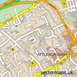
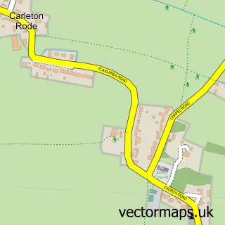
Nearby street map samples around New Buckenham

More street maps in Norfolk
750 metre map area coverage
Boundary, postcode and point of interest information for the 750m x 750m rectangle centred on this sample map.
Boundaries containing map centre
Constituency: Mid Norfolk Co Const
County: Norfolk County
District: Breckland District
Icb: NHS Norfolk and Waveney ICB
Parish: New Buckenham CP
Police Force: norfolk
Postcode District: NR16
Postcode Sector: NR16 2
Ward: The Buckenhams & Banham Ward
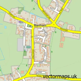
Nearby boundaries intersecting sample
Parish: Banham CP, Old Buckenham CP
Postcode District: NR17
Postcode Sector: NR17 1
Postcode coverage
POI category counts
Automotive Repair: 2
Anglican Church: 1
Bar: 1
Cafe: 1
Community Center: 1
Convenience Store: 1
Fashion Accessories Store: 1
Food Delivery Service: 1
Forestry Service: 1
Furniture Store: 1
Sample points of interest
- St Martin's, New Buckenham
- AAH Castle Hill Garage
- DNB Classic Car Restoration
- Kings Head
- Castle Cafe
- New Buckenham Village Hall
- Kings Stores
- The Other Curator
- Evri ParcelShop
- Broadland Tree Services
- Country Cootage Interiors
- St Mary'S Chapel
Create a larger editable map of New Buckenham
This sample shows only a 750 metre area. To create a larger map of New Buckenham, use our map builder to choose your own coverage area, add titles and download editable SVG, PDF and PNG files.
Create a custom map of New Buckenham