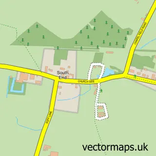
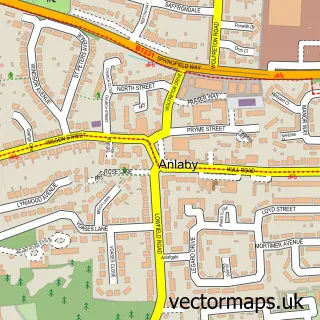
This New Holland street map is a detailed vector street map covering a 750m x 750m area. Select a larger area to create and download your own vector street map of New Holland.
The 750-metre map sample for New Holland covers 298 mapped buildings and approximately 9.1 km of road detail, of which 15 named roads are named. The immediate area includes 1 school and 1 MOT station, with 3 within 2 miles. The wider area around New Holland features 2 tourism points of interest and 1 campsite within 2 miles. To create a larger or custom map of New Holland, the map builder lets you define your own coverage area and download editable SVG, PDF and PNG files.
Create a larger editable map of New Holland
Choose any area you need and generate a high-quality vector map instantly. Perfect for print, planning, design, business and personal use.

This New Holland street map in Lincolnshire is available as downloadable SVG, PDF and PNG map files, or as a printed map for planning, business, display, education, local information and design work. You can also create a larger custom map area using the map selector.
What this New Holland map sample shows
New Holland lies within New Holland Cp parish, part of Ferry ward in the North Lincolnshire (B) local authority area. The postcode geography for this area includes the DN postcode area, the DN19 postcode district and the DN19 7 postcode sector. Residents fall under the Nhs Humber And North Yorkshire Integrated Care Board for NHS services.
Local features near New Holland
Within 2 milesAmenities and services in and around New Holland.
Administrative and postcode information for New Holland
New Holland lies within New Holland Cp parish, part of Ferry ward in the North Lincolnshire (B) local authority area. The postcode geography for this area includes the DN postcode area, the DN19 postcode district and the DN19 7 postcode sector. Residents fall under the Nhs Humber And North Yorkshire Integrated Care Board for NHS services.
Nearby street map samples around New Holland

More street maps in Lincolnshire
750 metre map area coverage
Boundary, postcode and point of interest information for the 750m x 750m rectangle centred on this sample map.
Boundaries containing map centre
Constituency: Brigg and Immingham Co Const
District: North Lincolnshire (B)
Icb: NHS Humber and North Yorkshire ICB
Parish: New Holland CP
Police Force: humberside
Postcode District: DN19
Postcode Sector: DN19 7
Ward: Ferry Ward
Nearby boundaries intersecting sample
No additional intersecting boundaries found.
Postcode coverage
POI category counts
Accountant: 1
Anglican Church: 1
Arts And Entertainment: 1
Attractions And Activities: 1
Bar: 1
Chinese Restaurant: 1
Convenience Store: 1
Elementary School: 1
Engineering Services: 1
Fashion Accessories Store: 1
Sample points of interest
- Tyers Accountancy
- Christ Church
- Family Hands
- Manchester Square - Green
- Magna Charter
- Oriental Star
- New Holland Village Shop
- New Holland Church of England and Methodist Primary School
- Genesis
- M a & H Woods
- H and MA Woods Coal Merchants
- Sherry Lighting and Design
Create a larger editable map of New Holland
This sample shows only a 750 metre area. To create a larger map of New Holland, use our map builder to choose your own coverage area, add titles and download editable SVG, PDF and PNG files.
Create a custom map of New Holland