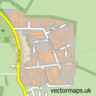
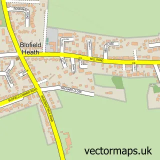
This New Rackheath street map is a detailed vector street map covering a 750m x 750m area. Select a larger area to create and download your own vector street map of New Rackheath.
The 750-metre map sample for New Rackheath covers 565 mapped buildings and approximately 10.1 km of road detail, of which 21 named roads are named. The immediate area includes 1 school, 2 pubs and 1 MOT station, with 5 within 2 miles. The wider area around New Rackheath features 1 tourism point of interest, 2 food and drink venues and 1 hotel. To create a larger or custom map of New Rackheath, the map builder lets you define your own coverage area and download editable SVG, PDF and PNG files.
Create a larger editable map of New Rackheath
Choose any area you need and generate a high-quality vector map instantly. Perfect for print, planning, design, business and personal use.

This New Rackheath street map in Norfolk is available as downloadable SVG, PDF and PNG map files, or as a printed map for planning, business, display, education, local information and design work. You can also create a larger custom map area using the map selector.
What this New Rackheath map sample shows
New Rackheath lies within Rackheath Cp parish, part of Wroxham ward in the Broadland District local authority area. The postcode geography for this area includes the NR postcode area, the NR13 postcode district and the NR13 6 postcode sector. Residents fall under the Nhs Norfolk And Waveney Integrated Care Board for NHS services.
Local features near New Rackheath
Within 2 milesAmenities and services in and around New Rackheath.
Administrative and postcode information for New Rackheath
New Rackheath lies within Rackheath Cp parish, part of Wroxham ward in the Broadland District local authority area. The postcode geography for this area includes the NR postcode area, the NR13 postcode district and the NR13 6 postcode sector. Residents fall under the Nhs Norfolk And Waveney Integrated Care Board for NHS services.
Nearby street map samples around New Rackheath

More street maps in Norfolk
750 metre map area coverage
Boundary, postcode and point of interest information for the 750m x 750m rectangle centred on this sample map.
Boundaries containing map centre
Constituency: Broadland and Fakenham Co Const
County: Norfolk County
District: Broadland District
Icb: NHS Norfolk and Waveney ICB
Parish: Rackheath CP
Police Force: norfolk
Postcode District: NR13
Postcode Sector: NR13 6
Ward: Wroxham Ward
Nearby boundaries intersecting sample
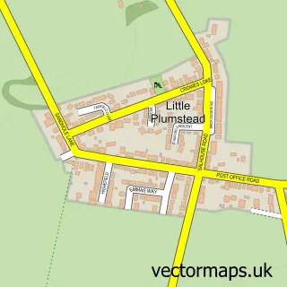
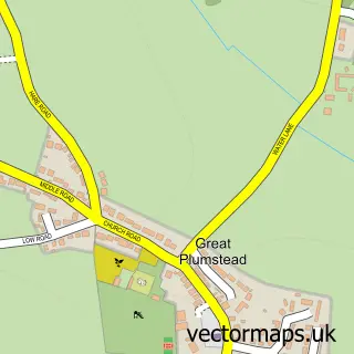
Parish: Great and Little Plumstead CP
Postcode Sector: NR13 5
Ward: Plumstead Ward
Postcode coverage
POI category counts
Electrician: 3
Hair Salon: 3
Beauty Salon: 2
Convenience Store: 2
Elementary School: 2
Flowers And Gifts Shop: 2
Package Locker: 2
Pub: 2
Shipping Center: 2
Advertising Agency: 1
Sample points of interest
- Myriad UK Limited
- Rackheath: Holy Trinity
- Blossom Beauty Room
- Smidge of Beauty
- Rackheath Paving & Fencing
- The Roofing & Scaffolding Co.Ltd
- Broadland Sweep
- Holy Trinity Church
- Premier
- Premier New Rackheath Store
- Changing Behaviour
- Post Office Travel Money
Create a larger editable map of New Rackheath
This sample shows only a 750 metre area. To create a larger map of New Rackheath, use our map builder to choose your own coverage area, add titles and download editable SVG, PDF and PNG files.
Create a custom map of New Rackheath