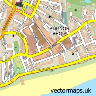
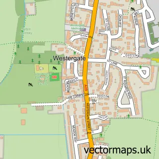
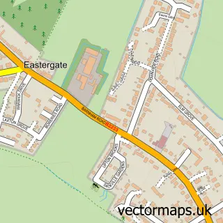
This North Bersted street map is a detailed vector street map covering a 750m x 750m area. Select a larger area to create and download your own vector street map of North Bersted.
The 750-metre map sample for North Bersted covers 369 mapped buildings and approximately 16.6 km of road detail, of which 28 named roads are named. The immediate area includes 1 school, 4 GP surgeries within 2 miles and 19 MOT stations within 2 miles. The wider area around North Bersted features 1 tourism point of interest, 1 hotel and 1 campsite within 2 miles. To create a larger or custom map of North Bersted, the map builder lets you define your own coverage area and download editable SVG, PDF and PNG files.
Create a larger editable map of North Bersted
Choose any area you need and generate a high-quality vector map instantly. Perfect for print, planning, design, business and personal use.

This North Bersted street map in West Sussex is available as downloadable SVG, PDF and PNG map files, or as a printed map for planning, business, display, education, local information and design work. You can also create a larger custom map area using the map selector.
What this North Bersted map sample shows
North Bersted lies within Bersted Cp parish, part of Bersted ward in the Arun District local authority area. The postcode geography for this area includes the PO postcode area, the PO22 postcode district and the PO22 9 postcode sector. Residents fall under the Nhs Sussex Integrated Care Board for NHS services.
Local features near North Bersted
Within 2 milesAmenities and services in and around North Bersted.
Administrative and postcode information for North Bersted
North Bersted lies within Bersted Cp parish, part of Bersted ward in the Arun District local authority area. The postcode geography for this area includes the PO postcode area, the PO22 postcode district and the PO22 9 postcode sector. Residents fall under the Nhs Sussex Integrated Care Board for NHS services.
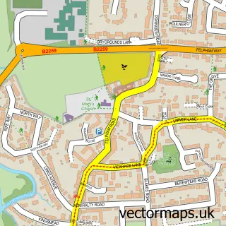
Nearby street map samples around North Bersted

More street maps in West Sussex
750 metre map area coverage
Boundary, postcode and point of interest information for the 750m x 750m rectangle centred on this sample map.
Boundaries containing map centre
Constituency: Chichester Co Const
County: West Sussex County
District: Arun District
Icb: NHS Surrey and Sussex ICB
Parish: Bersted CP
Police Force: sussex
Postcode District: PO22
Postcode Sector: PO22 9
Ward: Bersted Ward
Nearby boundaries intersecting sample
Postcode District: PO21
Postcode Sector: PO21 5
Postcode coverage
POI category counts
Bed And Breakfast: 2
Construction Services: 2
Electrician: 2
It Service And Computer Repair: 2
Armed Forces Branch: 1
Beauty And Spa: 1
Building Contractor: 1
Building Supply Store: 1
Campus Building: 1
Community Center: 1
Sample points of interest
- Op Endex
- DonnaTropic Skincare Lover
- The Old Priory
- Willow Rise
- Maplewood Building Services
- Surrey & Sussex Pools
- Southdowns College - Havant
- Bersted Park Community Centre
- Acrylic Render Specialist Limited
- Richard Jones Building
- Minters Paving
- Forest Knights
Create a larger editable map of North Bersted
This sample shows only a 750 metre area. To create a larger map of North Bersted, use our map builder to choose your own coverage area, add titles and download editable SVG, PDF and PNG files.
Create a custom map of North Bersted