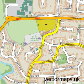
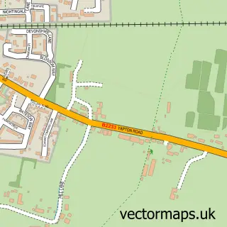
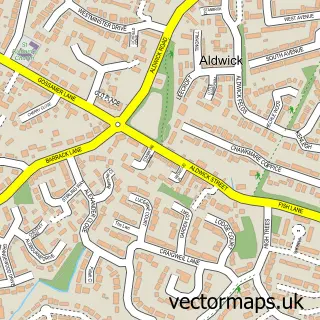
This Shripney street map is a detailed vector street map covering a 750m x 750m area. Select a larger area to create and download your own vector street map of Shripney.
The 750-metre map sample for Shripney covers 114 mapped buildings and approximately 6.4 km of road detail, of which 4 named roads are named. The immediate area includes 2 GP surgeries within 2 miles, 4 pubs and 17 MOT stations within 2 miles. The wider area around Shripney features 4 food and drink venues, 2 hotels and 1 campsite within 2 miles. To create a larger or custom map of Shripney, the map builder lets you define your own coverage area and download editable SVG, PDF and PNG files.
Create a larger editable map of Shripney
Choose any area you need and generate a high-quality vector map instantly. Perfect for print, planning, design, business and personal use.

This Shripney street map in West Sussex is available as downloadable SVG, PDF and PNG map files, or as a printed map for planning, business, display, education, local information and design work. You can also create a larger custom map area using the map selector.
What this Shripney map sample shows
Shripney lies within Bersted Cp parish, part of Bersted ward in the Arun District local authority area. The postcode geography for this area includes the PO postcode area, the PO22 postcode district and the PO22 9 postcode sector. Residents fall under the Nhs Sussex Integrated Care Board for NHS services.
Local features near Shripney
Within 2 milesAmenities and services in and around Shripney.
Administrative and postcode information for Shripney
The local authority covering Shripney is Arun District, within the county of West Sussex. The settlement lies within Bersted ward and Bersted Cp civil parish. The PO22 postcode district and PO22 9 postcode sector serve the immediate area. NHS provision in the area is delivered through University Hospitals Sussex Nhs Foundation Trust.
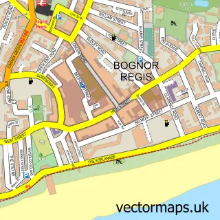
Nearby street map samples around Shripney

More street maps in West Sussex
750 metre map area coverage
Boundary, postcode and point of interest information for the 750m x 750m rectangle centred on this sample map.
Boundaries containing map centre
Constituency: Chichester Co Const
County: West Sussex County
District: Arun District
Icb: NHS Surrey and Sussex ICB
Parish: Bersted CP
Police Force: sussex
Postcode District: PO22
Postcode Sector: PO22 9
Ward: Bersted Ward
Nearby boundaries intersecting sample
Constituency: Arundel and South Downs Co Const
Parish: Aldingbourne CP
Ward: Barnham Ward
Postcode coverage
POI category counts
Pub: 4
Hotel: 2
Carpenter: 1
Caterer: 1
Contractor: 1
Cottage: 1
Electrical Wholesaler: 1
Flowers And Gifts Shop: 1
Masonry Contractors: 1
Monument: 1
Sample points of interest
- Brilyn Joinery
- Sloe & Wild
- Apj Builders
- Willow cottage
- Westside Supplies
- Wildflower studio
- Premier Inn
- Premier Inn Bognor Regis
- Memorial Stone Centre
- The Memorial Stone Centre
- Bathstore.com Ltd.
- Chef & Brewer
Create a larger editable map of Shripney
This sample shows only a 750 metre area. To create a larger map of Shripney, use our map builder to choose your own coverage area, add titles and download editable SVG, PDF and PNG files.
Create a custom map of Shripney