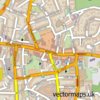
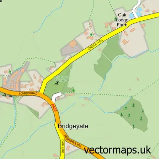
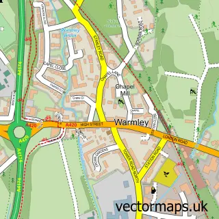
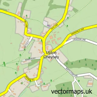
This North Common street map is a detailed vector street map covering a 750m x 750m area. Select a larger area to create and download your own vector street map of North Common.
The 750-metre map sample for North Common covers 414 mapped buildings and approximately 16.1 km of road detail, of which 38 named roads are named. The immediate area includes 2 schools, 1 GP surgery, with 4 within 2 miles, 3 pubs and 2 MOT stations, with 18 within 2 miles. The wider area around North Common features 1 tourism point of interest, 3 food and drink venues and 2 hotels. To create a larger or custom map of North Common, the map builder lets you define your own coverage area and download editable SVG, PDF and PNG files.
Create a larger editable map of North Common
Choose any area you need and generate a high-quality vector map instantly. Perfect for print, planning, design, business and personal use.

This North Common street map in Gloucestershire is available as downloadable SVG, PDF and PNG map files, or as a printed map for planning, business, display, education, local information and design work. You can also create a larger custom map area using the map selector.
What this North Common map sample shows
North Common lies within Siston Cp parish, part of Boyd Valley ward in the South Gloucestershire local authority area. The postcode geography for this area includes the BS postcode area, the BS30 postcode district and the BS30 5 postcode sector. Residents fall under the Nhs Bristol, North Somerset And South Gloucestershire Integrated Care Board for NHS services.
Local features near North Common
Within 2 milesAmenities and services in and around North Common.
Administrative and postcode information for North Common
The local authority covering North Common is South Gloucestershire, within the county of Gloucestershire. The settlement lies within Boyd Valley ward and Siston Cp civil parish. The BS30 postcode district and BS30 5 postcode sector serve the immediate area. NHS provision in the area is delivered through North Bristol Nhs Trust.
Nearby street map samples around North Common

More street maps in Gloucestershire
750 metre map area coverage
Boundary, postcode and point of interest information for the 750m x 750m rectangle centred on this sample map.
Boundaries containing map centre
Constituency: North East Somerset and Hanham Co Const
District: South Gloucestershire
Icb: NHS Bristol North Somerset and South Gloucestershire ICB
Parish: Bitton CP
Police Force: avon and somerset
Postcode District: BS30
Postcode Sector: BS30 5
Ward: Bitton & Oldland Common Ward
Nearby boundaries intersecting sample
Constituency: Thornbury and Yate Co Const
Parish: Siston CP
Postcode Sector: BS30 8, BS30 9
Ward: Boyd Valley Ward, Parkwall & Warmley Ward
Postcode coverage
POI category counts
Advertising Agency: 3
Automotive Repair: 3
Convenience Store: 3
Pub: 3
Retail: 3
Auto Electrical Repair: 2
Building Supply Store: 2
Child Care And Day Care: 2
Chiropractor: 2
Dance School: 2
Sample points of interest
- A5 Mbl
- Essentiamail
- Shipham Communications
- The Oven Doctor Bristol
- Jeeves Budgens (Swap) (Protected)
- R.B Auto Detailing
- Gregor Heating, Electrical & Renewable Energy
- Steve Gregor Plumbing & Heating
- Bridgeyate Motor Services
- SJ CURTIS Body Repair & Paint Centre
- SJ Curtis
- Mill Lane Automotive
Create a larger editable map of North Common
This sample shows only a 750 metre area. To create a larger map of North Common, use our map builder to choose your own coverage area, add titles and download editable SVG, PDF and PNG files.
Create a custom map of North Common