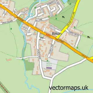
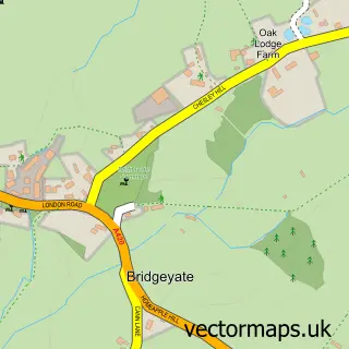
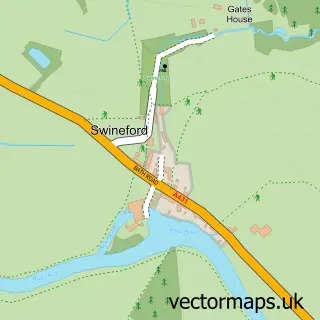
This Oldland Common street map is a detailed vector street map covering a 750m x 750m area. Select a larger area to create and download your own vector street map of Oldland Common.
The 750-metre map sample for Oldland Common covers 336 mapped buildings and approximately 12.3 km of road detail, of which 22 named roads are named. The immediate area includes 1 primary school and 1 secondary school, 1 railway station, 4 GP surgeries within 2 miles and 1 pub among other local services. The wider area around Oldland Common features 3 food and drink venues and 2 campsites within 2 miles. To create a larger or custom map of Oldland Common, the map builder lets you define your own coverage area and download editable SVG, PDF and PNG files.
Create a larger editable map of Oldland Common
Choose any area you need and generate a high-quality vector map instantly. Perfect for print, planning, design, business and personal use.

This Oldland Common street map in Gloucestershire is available as downloadable SVG, PDF and PNG map files, or as a printed map for planning, business, display, education, local information and design work. You can also create a larger custom map area using the map selector.
What this Oldland Common map sample shows
Oldland Common lies within Oldland Cp parish, part of Longwell Green ward in the South Gloucestershire local authority area. The postcode geography for this area includes the BS postcode area, the BS30 postcode district and the BS30 9 postcode sector. Residents fall under the Nhs Bristol, North Somerset And South Gloucestershire Integrated Care Board for NHS services.
Local features near Oldland Common
Within 2 milesAmenities and services in and around Oldland Common.
Administrative and postcode information for Oldland Common
Oldland Common lies within Oldland Cp parish, part of Longwell Green ward in the South Gloucestershire local authority area. The postcode geography for this area includes the BS postcode area, the BS30 postcode district and the BS30 9 postcode sector. Residents fall under the Nhs Bristol, North Somerset And South Gloucestershire Integrated Care Board for NHS services.
Nearby street map samples around Oldland Common

More street maps in Gloucestershire
750 metre map area coverage
Boundary, postcode and point of interest information for the 750m x 750m rectangle centred on this sample map.
Boundaries containing map centre
Constituency: North East Somerset and Hanham Co Const
District: South Gloucestershire
Icb: NHS Bristol North Somerset and South Gloucestershire ICB
Parish: Bitton CP
Police Force: avon and somerset
Postcode District: BS30
Postcode Sector: BS30 9
Ward: Bitton & Oldland Common Ward
Nearby boundaries intersecting sample
Postcode Sector: BS30 6, BS30 8
Postcode coverage
POI category counts
Electrician: 4
Doctor: 3
Pet Groomer: 3
Beauty Salon: 2
Cafe: 2
Carpenter: 2
Church Cathedral: 2
Convenience Store: 2
Elementary School: 2
Fish And Chips Restaurant: 2
Sample points of interest
- Oldland Abbotonians F.C.
- ATM (Post Office)
- PRW Automotive Services
- Oldland Ukulele Club
- Beauty Brows Bristol
- Saving Brows Bristol
- Post Office-Oldland Common
- Parker Willmor
- Climbing Wall Solutions
- Esthers Cafe
- Oldland cafe
- J G Bricklaying
Create a larger editable map of Oldland Common
This sample shows only a 750 metre area. To create a larger map of Oldland Common, use our map builder to choose your own coverage area, add titles and download editable SVG, PDF and PNG files.
Create a custom map of Oldland Common