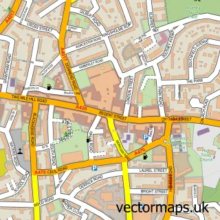
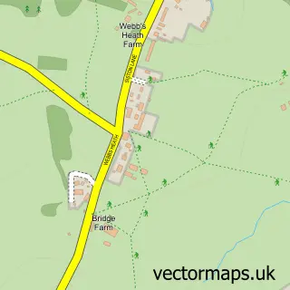
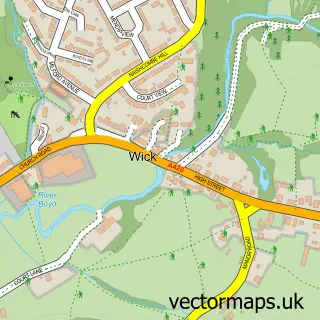
This Cadbury Heath street map is a detailed vector street map covering a 750m x 750m area. Select a larger area to create and download your own vector street map of Cadbury Heath.
The 750-metre map sample for Cadbury Heath covers 505 mapped buildings and approximately 23.2 km of road detail, of which 45 named roads are named. The immediate area includes 1 school, 7 GP surgeries within 2 miles and 25 MOT stations within 2 miles. The wider area around Cadbury Heath features 1 food and drink venue and 1 campsite within 2 miles. To create a larger or custom map of Cadbury Heath, the map builder lets you define your own coverage area and download editable SVG, PDF and PNG files.
Create a larger editable map of Cadbury Heath
Choose any area you need and generate a high-quality vector map instantly. Perfect for print, planning, design, business and personal use.

This Cadbury Heath street map in Gloucestershire is available as downloadable SVG, PDF and PNG map files, or as a printed map for planning, business, display, education, local information and design work. You can also create a larger custom map area using the map selector.
What this Cadbury Heath map sample shows
Cadbury Heath lies within Oldland Cp parish, part of Longwell Green ward in the South Gloucestershire local authority area. The postcode geography for this area includes the BS postcode area, the BS30 postcode district and the BS30 9 postcode sector. Residents fall under the Nhs Bristol, North Somerset And South Gloucestershire Integrated Care Board for NHS services.
Local features near Cadbury Heath
Within 2 milesAmenities and services in and around Cadbury Heath.
Administrative and postcode information for Cadbury Heath
Cadbury Heath lies within Oldland Cp parish, part of Longwell Green ward in the South Gloucestershire local authority area. The postcode geography for this area includes the BS postcode area, the BS30 postcode district and the BS30 9 postcode sector. Residents fall under the Nhs Bristol, North Somerset And South Gloucestershire Integrated Care Board for NHS services.
Nearby street map samples around Cadbury Heath

More street maps in Gloucestershire
750 metre map area coverage
Boundary, postcode and point of interest information for the 750m x 750m rectangle centred on this sample map.
Boundaries containing map centre
Constituency: North East Somerset and Hanham Co Const
District: South Gloucestershire
Icb: NHS Bristol North Somerset and South Gloucestershire ICB
Parish: Oldland CP
Police Force: avon and somerset
Postcode District: BS30
Postcode Sector: BS30 8
Ward: Parkwall & Warmley Ward
Nearby boundaries intersecting sample
Constituency: Bristol North East Boro Const
Postcode District: BS15
Postcode Sector: BS15 9, BS30 7
Ward: Woodstock Ward
Postcode coverage
POI category counts
Beauty Salon: 3
Professional Services: 3
Arts And Entertainment: 2
Building Supply Store: 2
Adult Education: 1
Advertising Agency: 1
Assisted Living Facility: 1
Automotive Services And Repair: 1
Business Consulting: 1
Cafe: 1
Sample points of interest
- Acorn Health & Safety Ltd.
- Hot Hibiscus Design
- Dobradi Art
- Mermaids UK Bristol
- Wraxall Road Nursing Home
- South West in Car Tech
- BeautyBits
- K Lashes And Beauty
- Kadies Nails & Beauty
- Granite Magic Luxury Worktops
- South West Glass
- Bristol Solar
Create a larger editable map of Cadbury Heath
This sample shows only a 750 metre area. To create a larger map of Cadbury Heath, use our map builder to choose your own coverage area, add titles and download editable SVG, PDF and PNG files.
Create a custom map of Cadbury Heath