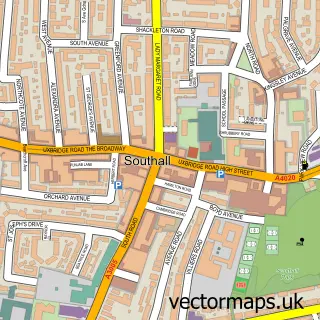
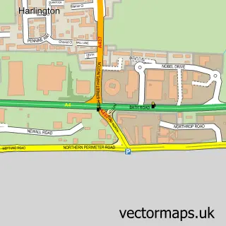
This North Hyde street map is a detailed vector street map covering a 750m x 750m area. Select a larger area to create and download your own vector street map of North Hyde.
The 750-metre map sample for North Hyde covers 381 mapped buildings and approximately 13.6 km of road detail, of which 27 named roads are named. The immediate area includes 2 schools, 36 GP surgeries within 2 miles, 1 pub and 41 MOT stations within 2 miles. The wider area around North Hyde features 1 tourism point of interest, 1 food and drink venue and 1 hotel. To create a larger or custom map of North Hyde, the map builder lets you define your own coverage area and download editable SVG, PDF and PNG files.
Create a larger editable map of North Hyde
Choose any area you need and generate a high-quality vector map instantly. Perfect for print, planning, design, business and personal use.

This North Hyde street map in Greater London is available as downloadable SVG, PDF and PNG map files, or as a printed map for planning, business, display, education, local information and design work. You can also create a larger custom map area using the map selector.
What this North Hyde map sample shows
North Hyde lies within Greater London Authority parish, part of Heston East ward in the Hounslow London Boro local authority area. The postcode geography for this area includes the TW postcode area, the TW5 postcode district and the TW5 0 postcode sector. Residents fall under the Nhs North West London Integrated Care Board for NHS services.
Local features near North Hyde
Within 2 milesAmenities and services in and around North Hyde.
Administrative and postcode information for North Hyde
North Hyde lies within Greater London Authority parish, part of Heston East ward in the Hounslow London Boro local authority area. The postcode geography for this area includes the TW postcode area, the TW5 postcode district and the TW5 0 postcode sector. Residents fall under the Nhs North West London Integrated Care Board for NHS services.
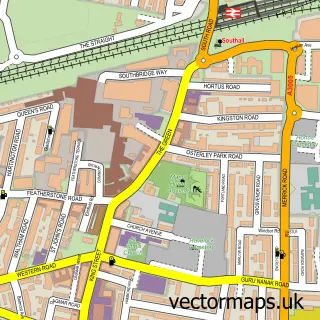
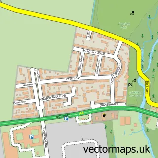
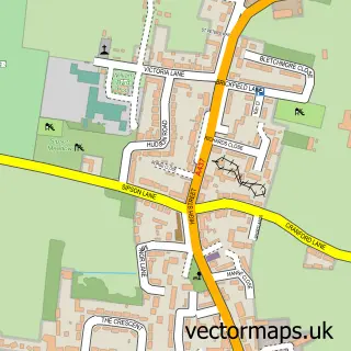
Nearby street map samples around North Hyde


More street maps in Greater London
750 metre map area coverage
Boundary, postcode and point of interest information for the 750m x 750m rectangle centred on this sample map.
Boundaries containing map centre
Constituency: Feltham and Heston Boro Const
County: Greater London Authority
District: Hounslow London Boro
Icb: NHS West and North London IC
Police Force: metropolitan
Postcode District: UB2
Postcode Sector: UB2 5
Ward: Heston West Ward
Nearby boundaries intersecting sample
Constituency: Brentford and Isleworth Boro Const, Ealing Southall Boro Const
District: Ealing London Boro
Postcode District: TW5
Postcode Sector: TW5 0, TW5 9
Ward: Heston East Ward, Norwood Green Ward, Southall Green Ward
Postcode coverage
POI category counts
Badminton Court: 2
Beauty Salon: 2
Lawyer: 2
Auto Body Shop: 1
Automotive Repair: 1
Building Contractor: 1
Building Supply Store: 1
Cabin: 1
Construction Services: 1
Contractor: 1
Sample points of interest
- Bodywork and Restoration Specialist
- Arian autos ltd
- Hounslow Badminton Centre
- Middlesex Badminton Dome
- Goodas Hair Design4kidz
- Neelams Beauty Room
- Enterprise Windows Ltd.
- Mudher Construction
- Grand Suits - Heathrow | Serviced Accommodation Southall
- Mudher Construction Ltd.
- Fateh 13 ltd
- Evri ParcelShop
Create a larger editable map of North Hyde
This sample shows only a 750 metre area. To create a larger map of North Hyde, use our map builder to choose your own coverage area, add titles and download editable SVG, PDF and PNG files.
Create a custom map of North Hyde