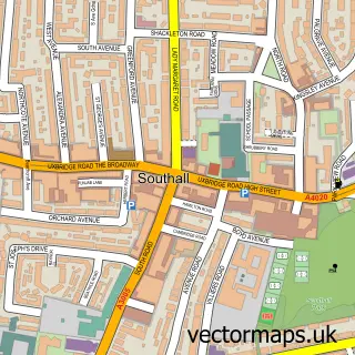
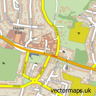
This Southall Green street map is a detailed vector street map covering a 750m x 750m area. Select a larger area to create and download your own vector street map of Southall Green.
The 750-metre map sample for Southall Green covers 268 mapped buildings and approximately 19.4 km of road detail, of which 40 named roads are named. The immediate area includes 1 school, 1 railway station, 3 GP surgeries, with 36 within 2 miles and 3 MOT stations, with 43 within 2 miles. The wider area around Southall Green features 5 tourism points of interest, 10 food and drink venues and 3 hotels. To create a larger or custom map of Southall Green, the map builder lets you define your own coverage area and download editable SVG, PDF and PNG files.
Create a larger editable map of Southall Green
Choose any area you need and generate a high-quality vector map instantly. Perfect for print, planning, design, business and personal use.

This Southall Green street map in Greater London is available as downloadable SVG, PDF and PNG map files, or as a printed map for planning, business, display, education, local information and design work. You can also create a larger custom map area using the map selector.
What this Southall Green map sample shows
Southall Green lies within Greater London Authority parish, part of Southall Broadway ward in the Ealing London Boro local authority area. The postcode geography for this area includes the UB postcode area, the UB1 postcode district and the UB1 1 postcode sector. Residents fall under the Nhs North West London Integrated Care Board for NHS services.
Local features near Southall Green
Within 2 milesAmenities and services in and around Southall Green.
Administrative and postcode information for Southall Green
Southall Green lies within Greater London Authority parish, part of Southall Broadway ward in the Ealing London Boro local authority area. The postcode geography for this area includes the UB postcode area, the UB1 postcode district and the UB1 1 postcode sector. Residents fall under the Nhs North West London Integrated Care Board for NHS services.
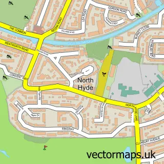
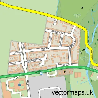
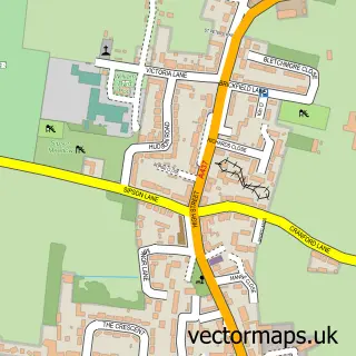
Nearby street map samples around Southall Green


More street maps in Greater London
750 metre map area coverage
Boundary, postcode and point of interest information for the 750m x 750m rectangle centred on this sample map.
Boundaries containing map centre
Constituency: Ealing Southall Boro Const
County: Greater London Authority
District: Ealing London Boro
Icb: NHS West and North London IC
Police Force: metropolitan
Postcode District: UB2
Postcode Sector: UB2 4
Ward: Southall Green Ward
Nearby boundaries intersecting sample
Postcode District: UB1
Postcode Sector: UB1 1, UB1 3, UB2 5
Ward: Norwood Green Ward, Southall Broadway Ward, Southall West Ward
Postcode coverage
POI category counts
Beauty Salon: 9
Automotive Repair: 8
Indian Restaurant: 8
Restaurant: 8
Building Supply Store: 6
Professional Services: 6
Real Estate Agent: 6
Charity Organization: 5
Doctor: 5
Jewelry Store: 5
Sample points of interest
- Karwan Restaurant
- Nargis Kapuri Pan
- Nargis Restaurant
- St John's Church Southall Green
- tudorrosevenue
- Bombay Halwa
- ATM (Post Office)
- Atm
- Sapna Express (Ltd)
- Complete Auto Repairs
- Southall Body Works
- Smart tyer
Create a larger editable map of Southall Green
This sample shows only a 750 metre area. To create a larger map of Southall Green, use our map builder to choose your own coverage area, add titles and download editable SVG, PDF and PNG files.
Create a custom map of Southall Green