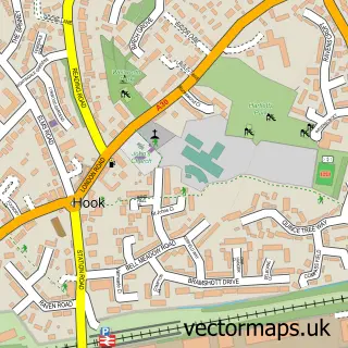
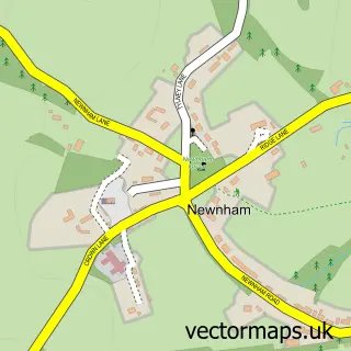
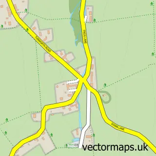
This North Warnborough street map is a detailed vector street map covering a 750m x 750m area. Select a larger area to create and download your own vector street map of North Warnborough.
The 750-metre map sample for North Warnborough covers 293 mapped buildings and approximately 10.2 km of road detail, of which 20 named roads are named. The immediate area includes 1 GP surgery within 2 miles, 1 pub and 5 MOT stations within 2 miles. The wider area around North Warnborough features 1 tourism point of interest and 1 food and drink venue. To create a larger or custom map of North Warnborough, the map builder lets you define your own coverage area and download editable SVG, PDF and PNG files.
Create a larger editable map of North Warnborough
Choose any area you need and generate a high-quality vector map instantly. Perfect for print, planning, design, business and personal use.

This North Warnborough street map in Hampshire is available as downloadable SVG, PDF and PNG map files, or as a printed map for planning, business, display, education, local information and design work. You can also create a larger custom map area using the map selector.
What this North Warnborough map sample shows
North Warnborough lies within Odiham Cp parish, part of Odiham ward in the Hart District local authority area. The postcode geography for this area includes the RG postcode area, the RG29 postcode district and the RG29 1 postcode sector. Residents fall under the Nhs Hampshire And Isle Of Wight Integrated Care Board for NHS services.
Local features near North Warnborough
Within 2 milesAmenities and services in and around North Warnborough.
Administrative and postcode information for North Warnborough
North Warnborough lies within Odiham Cp parish, part of Odiham ward in the Hart District local authority area. The postcode geography for this area includes the RG postcode area, the RG29 postcode district and the RG29 1 postcode sector. Residents fall under the Nhs Hampshire And Isle Of Wight Integrated Care Board for NHS services.
Nearby street map samples around North Warnborough

More street maps in Hampshire
750 metre map area coverage
Boundary, postcode and point of interest information for the 750m x 750m rectangle centred on this sample map.
Boundaries containing map centre
Constituency: North East Hampshire Co Const
County: Hampshire County
District: Hart District
Icb: NHS Hampshire and Isle of Wight ICB
Parish: Odiham CP
Police Force: hampshire
Postcode District: RG29
Postcode Sector: RG29 1
Ward: Odiham Ward
Nearby boundaries intersecting sample
Parish: Greywell CP
Postcode coverage
POI category counts
Gas Station: 4
Beauty Salon: 2
Acupuncture: 1
Atms: 1
Automotive: 1
Bakery: 1
Charity Organization: 1
Community Center: 1
Food Beverage Service Distribution: 1
Gardener: 1
Sample points of interest
- Square One
- MFG - North Warnborough (MRH), North Warnborough
- Toy Storage
- Odiham Cake Company
- Endulge Holistic Therapy
- The Beauty Studio Odiham
- W W 1 Aviation Heritage Trust
- North Warnborough Village Hall
- Aspire Catering
- Avenue Landscapes
- ESSO MFG NORTH WARNBOROUGH
- ESSO Station
Create a larger editable map of North Warnborough
This sample shows only a 750 metre area. To create a larger map of North Warnborough, use our map builder to choose your own coverage area, add titles and download editable SVG, PDF and PNG files.
Create a custom map of North Warnborough