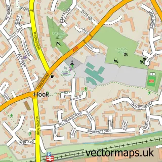
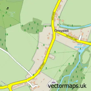
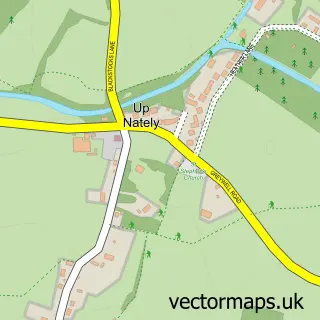
This South Warnborough street map is a detailed vector street map covering a 750m x 750m area. Select a larger area to create and download your own vector street map of South Warnborough.
The 750-metre map sample for South Warnborough covers 194 mapped buildings and approximately 17.6 km of road detail, of which 9 named roads are named. The immediate area includes 1 pub and 1 MOT station. The wider area around South Warnborough features 2 food and drink venues. To create a larger or custom map of South Warnborough, the map builder lets you define your own coverage area and download editable SVG, PDF and PNG files.
Create a larger editable map of South Warnborough
Choose any area you need and generate a high-quality vector map instantly. Perfect for print, planning, design, business and personal use.

This South Warnborough street map in Hampshire is available as downloadable SVG, PDF and PNG map files, or as a printed map for planning, business, display, education, local information and design work. You can also create a larger custom map area using the map selector.
What this South Warnborough map sample shows
South Warnborough lies within South Warnborough Cp parish, part of Odiham ward in the Hart District local authority area. The postcode geography for this area includes the RG postcode area, the RG29 postcode district and the RG29 1 postcode sector. Residents fall under the Nhs Hampshire And Isle Of Wight Integrated Care Board for NHS services.
Local features near South Warnborough
Within 2 milesAmenities and services in and around South Warnborough.
Administrative and postcode information for South Warnborough
The local authority covering South Warnborough is Hart District, within the county of Hampshire. The settlement lies within Odiham ward and South Warnborough Cp civil parish. The RG29 postcode district and RG29 1 postcode sector serve the immediate area. NHS provision in the area is delivered through Hampshire Hospitals Nhs Foundation Trust.
Nearby street map samples around South Warnborough

More street maps in Hampshire
750 metre map area coverage
Boundary, postcode and point of interest information for the 750m x 750m rectangle centred on this sample map.
Boundaries containing map centre
Constituency: North East Hampshire Co Const
County: Hampshire County
District: Hart District
Icb: NHS Hampshire and Isle of Wight ICB
Parish: South Warnborough CP
Police Force: hampshire
Postcode District: RG29
Postcode Sector: RG29 1
Ward: Odiham Ward
Nearby boundaries intersecting sample
No additional intersecting boundaries found.
Postcode coverage
POI category counts
Event Planning: 2
Wholesale Store: 2
Anglican Church: 1
Automotive Repair: 1
Automotive Services And Repair: 1
Building Contractor: 1
Cafe: 1
Cards And Stationery Store: 1
Church Cathedral: 1
Cleaning Services: 1
Sample points of interest
- St Andrew's, South Warnborough
- MK1 Automotive
- Imax Systems
- Michael Sweeney Ltd.
- South Warnborough Village Shop
- Wyeth Digital Ltd.
- St Andrews Church
- Chimney Sweep Direct
- MJW Clocks
- South warnborough village shop
- Selene Maher Counselling
- Fruitful
Create a larger editable map of South Warnborough
This sample shows only a 750 metre area. To create a larger map of South Warnborough, use our map builder to choose your own coverage area, add titles and download editable SVG, PDF and PNG files.
Create a custom map of South Warnborough