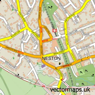
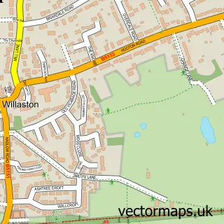
This Parkgate street map is a detailed vector street map covering a 750m x 750m area. Select a larger area to create and download your own vector street map of Parkgate.
The 750-metre map sample for Parkgate covers 369 mapped buildings and approximately 11.1 km of road detail, of which 23 named roads are named. The immediate area includes 1 school, 2 GP surgeries within 2 miles, 1 pub and 8 MOT stations within 2 miles. The wider area around Parkgate features 3 tourism points of interest and 3 food and drink venues. To create a larger or custom map of Parkgate, the map builder lets you define your own coverage area and download editable SVG, PDF and PNG files.
Create a larger editable map of Parkgate
Choose any area you need and generate a high-quality vector map instantly. Perfect for print, planning, design, business and personal use.

This Parkgate street map in Cheshire is available as downloadable SVG, PDF and PNG map files, or as a printed map for planning, business, display, education, local information and design work. You can also create a larger custom map area using the map selector.
What this Parkgate map sample shows
Parkgate lies within Neston Cp parish, part of Parkgate ward in the Cheshire West And Chester (B) local authority area. The postcode geography for this area includes the CH postcode area, the CH64 postcode district and the CH64 6 postcode sector. Residents fall under the Nhs Cheshire And Merseyside Integrated Care Board for NHS services.
Local features near Parkgate
Within 2 milesAmenities and services in and around Parkgate.
Administrative and postcode information for Parkgate
The local authority covering Parkgate is Cheshire West And Chester (B), within the county of Cheshire. The settlement lies within Parkgate ward and Neston Cp civil parish. The CH64 postcode district and CH64 6 postcode sector serve the immediate area. NHS provision in the area is delivered through Wirral University Teaching Hospital Nhs Foundation Trust.
Nearby street map samples around Parkgate

More street maps in Cheshire
750 metre map area coverage
Boundary, postcode and point of interest information for the 750m x 750m rectangle centred on this sample map.
Boundaries containing map centre
Constituency: Chester North and Neston Co Const
District: Cheshire West and Chester (B)
Icb: NHS Cheshire and Merseyside ICB
Parish: Neston CP
Police Force: cheshire
Postcode District: CH64
Postcode Sector: CH64 6
Ward: Parkgate Ward
Nearby boundaries intersecting sample
No additional intersecting boundaries found.
Postcode coverage
POI category counts
Caterer: 2
Ice Cream Shop: 2
Park: 2
American Restaurant: 1
Anglican Church: 1
Art Gallery: 1
Bar: 1
Beauty Salon: 1
Beer Bar: 1
Bicycle Shop: 1
Sample points of interest
- The Lobster Grill
- St Thomas the Apostle
- Artroom Gallery
- Elephant's Monthly Open Mic
- Natural Beauty by Emma
- The Red Lion
- Wheel Worx Wirral
- Novidec
- Fellici's Ice Cream Carts
- Flame and Hog
- Chows Eating House
- St Thomas
Create a larger editable map of Parkgate
This sample shows only a 750 metre area. To create a larger map of Parkgate, use our map builder to choose your own coverage area, add titles and download editable SVG, PDF and PNG files.
Create a custom map of Parkgate