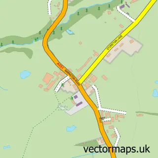
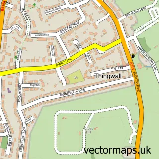
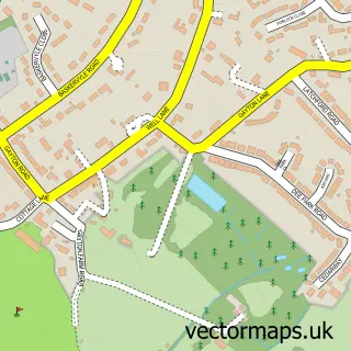
This Brimstage street map is a detailed vector street map covering a 750m x 750m area. Select a larger area to create and download your own vector street map of Brimstage.
The 750-metre map sample for Brimstage covers 40 mapped buildings and approximately 5.6 km of road detail, of which 4 named roads are named. The immediate area includes 6 GP surgeries within 2 miles and 5 MOT stations within 2 miles. The wider area around Brimstage features 2 food and drink venues. To create a larger or custom map of Brimstage, the map builder lets you define your own coverage area and download editable SVG, PDF and PNG files.
Create a larger editable map of Brimstage
Choose any area you need and generate a high-quality vector map instantly. Perfect for print, planning, design, business and personal use.

This Brimstage street map in Merseyside is available as downloadable SVG, PDF and PNG map files, or as a printed map for planning, business, display, education, local information and design work. You can also create a larger custom map area using the map selector.
What this Brimstage map sample shows
Brimstage lies within Wirral District (B) parish, part of Clatterbridge ward in the Wirral District (B) local authority area. The postcode geography for this area includes the CH postcode area, the CH63 postcode district and the CH63 6 postcode sector. Residents fall under the Nhs Cheshire And Merseyside Integrated Care Board for NHS services.
Local features near Brimstage
Within 2 milesAmenities and services in and around Brimstage.
Administrative and postcode information for Brimstage
Brimstage lies within Wirral District (B) parish, part of Clatterbridge ward in the Wirral District (B) local authority area. The postcode geography for this area includes the CH postcode area, the CH63 postcode district and the CH63 6 postcode sector. Residents fall under the Nhs Cheshire And Merseyside Integrated Care Board for NHS services.
Nearby street map samples around Brimstage

More street maps in Merseyside
750 metre map area coverage
Boundary, postcode and point of interest information for the 750m x 750m rectangle centred on this sample map.
Boundaries containing map centre
Constituency: Wirral West Co Const
District: Wirral District (B)
Icb: NHS Cheshire and Merseyside ICB
Police Force: merseyside
Postcode District: CH63
Postcode Sector: CH63 6
Ward: Clatterbridge Ward
Nearby boundaries intersecting sample
No additional intersecting boundaries found.
Postcode coverage
POI category counts
Beauty Salon: 3
Preschool: 3
Coffee Shop: 2
Farm: 2
Art Gallery: 1
Arts And Crafts: 1
Bar: 1
Brewery: 1
Bridal Shop: 1
Counseling And Mental Health: 1
Sample points of interest
- The Stables Boutique & Art And Craft Studio
- Courtyard Crafts
- The Mouse at Brimstage
- Alexandra B SPMU
- Deborah Alfa
- Leigh Jordan Hairdressing
- Brimstage Brewery
- Bellissima Brides
- Country Mouse Restaurant
- The Courtyard Coffee Shop and Cafe
- Bluebell Aesthetics
- Brimstage Engineering Solutions
Create a larger editable map of Brimstage
This sample shows only a 750 metre area. To create a larger map of Brimstage, use our map builder to choose your own coverage area, add titles and download editable SVG, PDF and PNG files.
Create a custom map of Brimstage