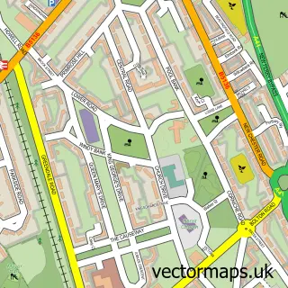
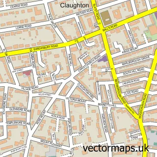
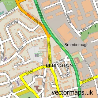
This Bebington street map is a detailed vector street map covering a 750m x 750m area. Select a larger area to create and download your own vector street map of Bebington.
The 750-metre map sample for Bebington covers 420 mapped buildings and approximately 18.1 km of road detail, of which 39 named roads are named. The immediate area includes 1 GP surgery, with 9 within 2 miles, 3 pubs and 15 MOT stations within 2 miles. The wider area around Bebington features 1 tourism point of interest and 8 food and drink venues. To create a larger or custom map of Bebington, the map builder lets you define your own coverage area and download editable SVG, PDF and PNG files.
Create a larger editable map of Bebington
Choose any area you need and generate a high-quality vector map instantly. Perfect for print, planning, design, business and personal use.

This Bebington street map in Merseyside is available as downloadable SVG, PDF and PNG map files, or as a printed map for planning, business, display, education, local information and design work. You can also create a larger custom map area using the map selector.
What this Bebington map sample shows
Bebington lies within Wirral District (B) parish, part of Bromborough ward in the Wirral District (B) local authority area. The postcode geography for this area includes the CH postcode area, the CH62 postcode district and the CH62 4 postcode sector. Residents fall under the Nhs Cheshire And Merseyside Integrated Care Board for NHS services.
Local features near Bebington
Within 2 milesAmenities and services in and around Bebington.
Administrative and postcode information for Bebington
Bebington lies within Wirral District (B) parish, part of Bromborough ward in the Wirral District (B) local authority area. The postcode geography for this area includes the CH postcode area, the CH62 postcode district and the CH62 4 postcode sector. Residents fall under the Nhs Cheshire And Merseyside Integrated Care Board for NHS services.
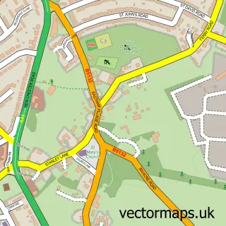
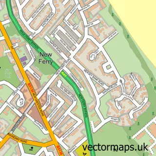
Nearby street map samples around Bebington

More street maps in Merseyside
750 metre map area coverage
Boundary, postcode and point of interest information for the 750m x 750m rectangle centred on this sample map.
Boundaries containing map centre
Constituency: Birkenhead Boro Const
District: Wirral District (B)
Icb: NHS Cheshire and Merseyside ICB
Police Force: merseyside
Postcode District: CH63
Postcode Sector: CH63 7
Ward: Bebington Ward
Nearby boundaries intersecting sample
Constituency: Ellesmere Port and Bromborough Boro Const, Wirral West Co Const
Postcode District: CH62
Postcode Sector: CH62 5, CH63 2, CH63 3
Ward: Bromborough Ward, Clatterbridge Ward
Postcode coverage
POI category counts
Real Estate Agent: 7
Barber: 5
Beauty Salon: 4
Dentist: 4
Hair Salon: 4
Beauty And Spa: 3
Church Cathedral: 3
Flowers And Gifts Shop: 3
Pub: 3
Builders: 2
Sample points of interest
- Bebington: St Andrew
- Tapleys Art and Graphics
- Londis Bebington (ATMaaS)
- 17 Newsham Drive Management Company Limited
- John George Hairdressing
- Macho Turkish Barbers
- Robbi Ross
- The Bebington Barber
- The Village Barber’s Bebington | Bebington
- By Charlotte SPMU & Laser
- Jenna Kate MUA and Beauty
- Revive Luxe
Create a larger editable map of Bebington
This sample shows only a 750 metre area. To create a larger map of Bebington, use our map builder to choose your own coverage area, add titles and download editable SVG, PDF and PNG files.
Create a custom map of Bebington