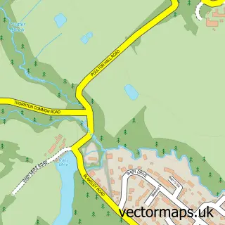
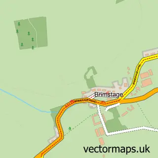
This Bromborough street map is a detailed vector street map covering a 750m x 750m area. Select a larger area to create and download your own vector street map of Bromborough.
The 750-metre map sample for Bromborough covers 326 mapped buildings and approximately 17.1 km of road detail, of which 33 named roads are named. The immediate area includes 1 GP surgery, with 4 within 2 miles, 5 pubs and 2 MOT stations, with 10 within 2 miles. The wider area around Bromborough features 1 tourism point of interest, 15 food and drink venues and 1 hotel. To create a larger or custom map of Bromborough, the map builder lets you define your own coverage area and download editable SVG, PDF and PNG files.
Create a larger editable map of Bromborough
Choose any area you need and generate a high-quality vector map instantly. Perfect for print, planning, design, business and personal use.

This Bromborough street map in Merseyside is available as downloadable SVG, PDF and PNG map files, or as a printed map for planning, business, display, education, local information and design work. You can also create a larger custom map area using the map selector.
What this Bromborough map sample shows
Bromborough lies within Wirral District (B) parish, part of Bromborough ward in the Wirral District (B) local authority area. The postcode geography for this area includes the CH postcode area, the CH62 postcode district and the CH62 3 postcode sector. Residents fall under the Nhs Cheshire And Merseyside Integrated Care Board for NHS services.
Local features near Bromborough
Within 2 milesAmenities and services in and around Bromborough.
Administrative and postcode information for Bromborough
The local authority covering Bromborough is Wirral District (B), within the county of Merseyside. The settlement lies within Bromborough ward and Wirral District (B) civil parish. The CH62 postcode district and CH62 3 postcode sector serve the immediate area. NHS provision in the area is delivered through Wirral University Teaching Hospital Nhs Foundation Trust.
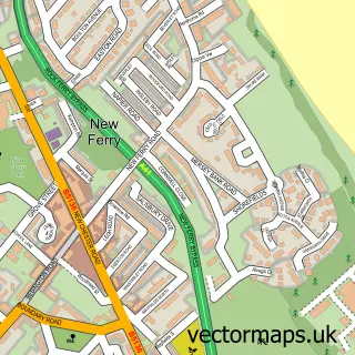
Nearby street map samples around Bromborough

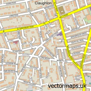
More street maps in Merseyside
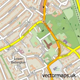
750 metre map area coverage
Boundary, postcode and point of interest information for the 750m x 750m rectangle centred on this sample map.
Boundaries containing map centre
Constituency: Ellesmere Port and Bromborough Boro Const
District: Wirral District (B)
Icb: NHS Cheshire and Merseyside ICB
Police Force: merseyside
Postcode District: CH62
Postcode Sector: CH62 7
Ward: Bromborough Ward
Nearby boundaries intersecting sample
Postcode Sector: CH62 2, CH62 3
Postcode coverage
POI category counts
Building Supply Store: 8
Real Estate Agent: 8
Beauty Salon: 7
Professional Services: 7
Package Locker: 6
Barber: 5
Hair Salon: 5
Pub: 5
Automotive Repair: 4
Cafe: 4
Sample points of interest
- Horner Downey & Co.
- Pennington Williams
- Wainwrights Accountants
- Wirral Cheer Academy
- Jumbuk Digital
- Moreton Press
- Tranceformations Now
- Tranceformations Now
- St Barnabas Church
- St. Barnabas, Bromborough
- Claire House Shops
- Todhunter Davies
Create a larger editable map of Bromborough
This sample shows only a 750 metre area. To create a larger map of Bromborough, use our map builder to choose your own coverage area, add titles and download editable SVG, PDF and PNG files.
Create a custom map of Bromborough