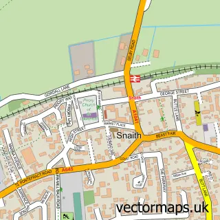
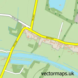
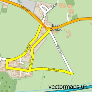
This Pollington street map is a detailed vector street map covering a 750m x 750m area. Select a larger area to create and download your own vector street map of Pollington.
The 750-metre map sample for Pollington covers 160 mapped buildings and approximately 5.1 km of road detail, of which 7 named roads are named. The immediate area includes 1 pub. The wider area around Pollington features 2 food and drink venues and 1 hotel. To create a larger or custom map of Pollington, the map builder lets you define your own coverage area and download editable SVG, PDF and PNG files.
Create a larger editable map of Pollington
Choose any area you need and generate a high-quality vector map instantly. Perfect for print, planning, design, business and personal use.

This Pollington street map in East Riding of Yorkshire is available as downloadable SVG, PDF and PNG map files, or as a printed map for planning, business, display, education, local information and design work. You can also create a larger custom map area using the map selector.
What this Pollington map sample shows
Pollington lies within Pollington Cp parish, part of Snaith, Airmyn, Rawcliffe And Marshland ward in the East Riding Of Yorkshire local authority area. The postcode geography for this area includes the DN postcode area, the DN14 postcode district and the DN14 0 postcode sector. Residents fall under the Nhs Humber And North Yorkshire Integrated Care Board for NHS services.
Local features near Pollington
Within 2 milesAmenities and services in and around Pollington.
Administrative and postcode information for Pollington
Pollington lies within Pollington Cp parish, part of Snaith, Airmyn, Rawcliffe And Marshland ward in the East Riding Of Yorkshire local authority area. The postcode geography for this area includes the DN postcode area, the DN14 postcode district and the DN14 0 postcode sector. Residents fall under the Nhs Humber And North Yorkshire Integrated Care Board for NHS services.
Nearby street map samples around Pollington

More street maps in East Riding of Yorkshire
750 metre map area coverage
Boundary, postcode and point of interest information for the 750m x 750m rectangle centred on this sample map.
Boundaries containing map centre
Constituency: Goole and Pocklington Co Const
District: East Riding of Yorkshire
Icb: NHS Humber and North Yorkshire ICB
Parish: Pollington CP
Police Force: humberside
Postcode District: DN14
Postcode Sector: DN14 0
Ward: Snaith, Airmyn, Rawcliffe and Marshland Ward
Nearby boundaries intersecting sample
No additional intersecting boundaries found.
Postcode coverage
POI category counts
Advertising Agency: 2
Sports Club And League: 2
Bed And Breakfast: 1
Bridal Shop: 1
Building Supply Store: 1
Cafe: 1
Community Center: 1
Construction Services: 1
Equestrian Facility: 1
Hardware Store: 1
Sample points of interest
- F.C Pollington
- Mooi Design
- Fir Tree Barn Guest House
- Gary Smith Photography
- CPM Group
- Nancy's Cafe
- Pollington Village Hall
- Cpm Pollington
- The Horse Bit Shop
- A J Bathroom Solutions
- Bellvue Party House
- Parkside Guest House
Create a larger editable map of Pollington
This sample shows only a 750 metre area. To create a larger map of Pollington, use our map builder to choose your own coverage area, add titles and download editable SVG, PDF and PNG files.
Create a custom map of Pollington