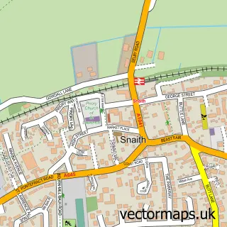
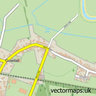
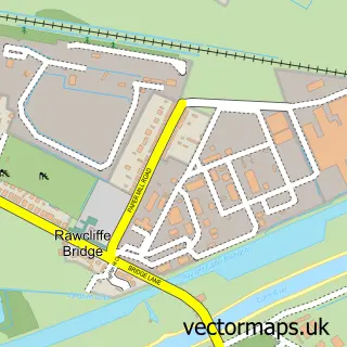
This West Cowick street map is a detailed vector street map covering a 750m x 750m area. Select a larger area to create and download your own vector street map of West Cowick.
The 750-metre map sample for West Cowick covers 258 mapped buildings and approximately 13.1 km of road detail, of which 21 named roads are named. The immediate area includes 1 GP surgery within 2 miles, 2 pubs and 1 MOT station, with 4 within 2 miles. The wider area around West Cowick features 2 food and drink venues and 1 campsite within 2 miles. To create a larger or custom map of West Cowick, the map builder lets you define your own coverage area and download editable SVG, PDF and PNG files.
Create a larger editable map of West Cowick
Choose any area you need and generate a high-quality vector map instantly. Perfect for print, planning, design, business and personal use.

This West Cowick street map in East Riding of Yorkshire is available as downloadable SVG, PDF and PNG map files, or as a printed map for planning, business, display, education, local information and design work. You can also create a larger custom map area using the map selector.
What this West Cowick map sample shows
West Cowick lies within Snaith And Cowick Cp parish, part of Snaith, Airmyn, Rawcliffe And Marshland ward in the East Riding Of Yorkshire local authority area. The postcode geography for this area includes the DN postcode area, the DN14 postcode district and the DN14 9 postcode sector. Residents fall under the Nhs Humber And North Yorkshire Integrated Care Board for NHS services.
Local features near West Cowick
Within 2 milesAmenities and services in and around West Cowick.
Administrative and postcode information for West Cowick
West Cowick lies within Snaith And Cowick Cp parish, part of Snaith, Airmyn, Rawcliffe And Marshland ward in the East Riding Of Yorkshire local authority area. The postcode geography for this area includes the DN postcode area, the DN14 postcode district and the DN14 9 postcode sector. Residents fall under the Nhs Humber And North Yorkshire Integrated Care Board for NHS services.
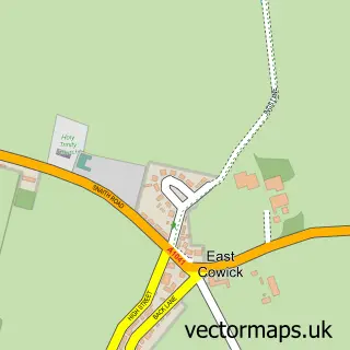
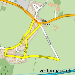
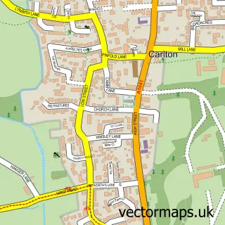
Nearby street map samples around West Cowick

More street maps in East Riding of Yorkshire
750 metre map area coverage
Boundary, postcode and point of interest information for the 750m x 750m rectangle centred on this sample map.
Boundaries containing map centre
Constituency: Goole and Pocklington Co Const
District: East Riding of Yorkshire
Icb: NHS Humber and North Yorkshire ICB
Parish: Snaith and Cowick CP
Police Force: humberside
Postcode District: DN14
Postcode Sector: DN14 9
Ward: Snaith, Airmyn, Rawcliffe and Marshland Ward
Nearby boundaries intersecting sample
No additional intersecting boundaries found.
Postcode coverage
POI category counts
Pub: 2
Automotive Repair: 1
Brewery: 1
Disability Services And Support Organization: 1
Doctor: 1
Freight And Cargo Service: 1
Grain Production: 1
Home Cleaning: 1
Motorcycle Dealer: 1
Pet Services: 1
Sample points of interest
- GCDMOT Garage
- Spotlight Brewing
- Goddards Care Homes
- Chatsworth & Co Business Services
- Paul Cooper Transport
- JF Cheeseman lawnmower And garden machinery
- Green Pig Cleaning Services
- Adi'S Workshop
- Cassie's K9 Clips
- The Ship
- The Ship Inn
- Underpinner Spares
Create a larger editable map of West Cowick
This sample shows only a 750 metre area. To create a larger map of West Cowick, use our map builder to choose your own coverage area, add titles and download editable SVG, PDF and PNG files.
Create a custom map of West Cowick