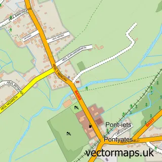
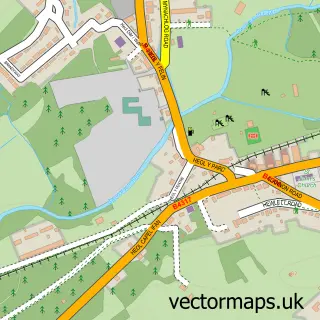
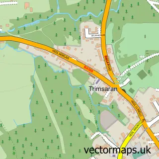
This Pont-henri street map is a detailed vector street map covering a 750m x 750m area. Select a larger area to create and download your own vector street map of Pont-henri.
The 750-metre map sample for Pont-henri covers 260 mapped buildings and approximately 11.6 km of road detail, of which 9 named roads are named. The immediate area includes 1 school and 1 MOT station, with 3 within 2 miles. To create a larger or custom map of Pont-henri, the map builder lets you define your own coverage area and download editable SVG, PDF and PNG files.
Create a larger editable map of Pont-henri
Choose any area you need and generate a high-quality vector map instantly. Perfect for print, planning, design, business and personal use.

This Pont-henri street map in Dyfed is available as downloadable SVG, PDF and PNG map files, or as a printed map for planning, business, display, education, local information and design work. You can also create a larger custom map area using the map selector.
What this Pont-henri map sample shows
Pont-henri lies within Llanelli Rural Community parish, part of Glyn ward in the Sir Gaerfyrddin - Carmarthenshire local authority area. The postcode geography for this area includes the SA postcode area, the SA15 postcode district and the SA15 5 postcode sector. Residents fall under the Hywel Dda University Health Board for NHS services.
Local features near Pont-henri
Within 2 milesAmenities and services in and around Pont-henri.
Administrative and postcode information for Pont-henri
The local authority covering Pont-henri is Sir Gaerfyrddin - Carmarthenshire, within the county of Dyfed. The settlement lies within Glyn ward and Llanelli Rural Community civil parish. The SA15 postcode district and SA15 5 postcode sector serve the immediate area. NHS provision in the area is delivered through Hywel Dda University Health Board.
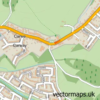
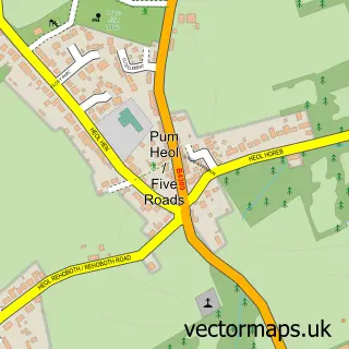
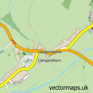
Nearby street map samples around Pont-henri

More street maps in Dyfed
750 metre map area coverage
Boundary, postcode and point of interest information for the 750m x 750m rectangle centred on this sample map.
Boundaries containing map centre
Constituency: Llanelli Co Const
District: Sir Gaerfyrddin - Carmarthenshire
Icb: Hywel Dda
Parish: Llanelli Rural Community
Police Force: dyfed-powys
Postcode District: SA15
Postcode Sector: SA15 5
Nearby boundaries intersecting sample
Parish: Llangyndeyrn Community
Postcode coverage
POI category counts
Building Supply Store: 2
Contractor: 2
Elementary School: 2
Architectural Designer: 1
Bakery: 1
Beauty And Spa: 1
Engineering Services: 1
Event Photography: 1
Martial Arts Club: 1
Massage Therapy: 1
Sample points of interest
- Hafod Design ltd
- Bev's Brownies and Bakes
- MUSE nails & beauty
- CMF - Custom Made Furniture
- City Moves
- Alan Rees and Sons Tarmacadam Contractors
- Copefield Construction
- Ponthenry County Primary School
- Ysgol Gynradd Ponthenri
- Towy Engineering Ltd
- Ultrabooth
- Ffordd Draig Karate
Create a larger editable map of Pont-henri
This sample shows only a 750 metre area. To create a larger map of Pont-henri, use our map builder to choose your own coverage area, add titles and download editable SVG, PDF and PNG files.
Create a custom map of Pont-henri