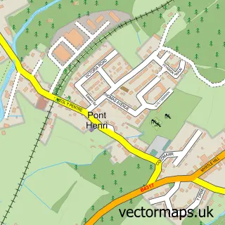
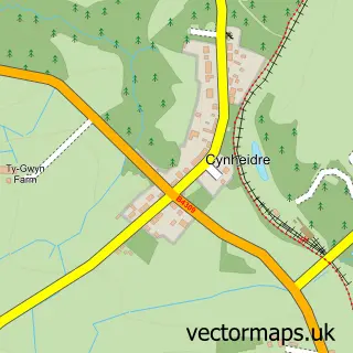
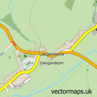
This Pont-iets street map is a detailed vector street map covering a 750m x 750m area. Select a larger area to create and download your own vector street map of Pont-iets.
The 750-metre map sample for Pont-iets covers 184 mapped buildings and approximately 8.0 km of road detail, of which 10 named roads are named. The immediate area includes 1 pub and 2 MOT stations within 2 miles. The wider area around Pont-iets features 2 food and drink venues. To create a larger or custom map of Pont-iets, the map builder lets you define your own coverage area and download editable SVG, PDF and PNG files.
Create a larger editable map of Pont-iets
Choose any area you need and generate a high-quality vector map instantly. Perfect for print, planning, design, business and personal use.

This Pont-iets street map in Dyfed is available as downloadable SVG, PDF and PNG map files, or as a printed map for planning, business, display, education, local information and design work. You can also create a larger custom map area using the map selector.
What this Pont-iets map sample shows
Pont-iets lies within Llanelli Rural Community parish, part of Glyn ward in the Sir Gaerfyrddin - Carmarthenshire local authority area. The postcode geography for this area includes the SA postcode area, the SA15 postcode district and the SA15 5 postcode sector. Residents fall under the Hywel Dda University Health Board for NHS services.
Local features near Pont-iets
Within 2 milesAmenities and services in and around Pont-iets.
Administrative and postcode information for Pont-iets
Pont-iets lies within Llanelli Rural Community parish, part of Glyn ward in the Sir Gaerfyrddin - Carmarthenshire local authority area. The postcode geography for this area includes the SA postcode area, the SA15 postcode district and the SA15 5 postcode sector. Residents fall under the Hywel Dda University Health Board for NHS services.
Nearby street map samples around Pont-iets

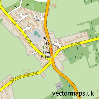
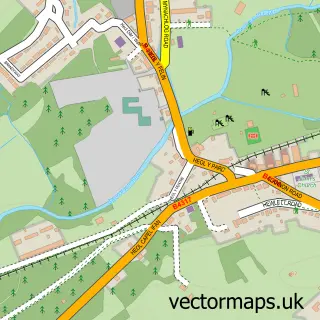
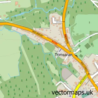
More street maps in Dyfed
750 metre map area coverage
Boundary, postcode and point of interest information for the 750m x 750m rectangle centred on this sample map.
Boundaries containing map centre
Constituency: Llanelli Co Const
District: Sir Gaerfyrddin - Carmarthenshire
Icb: Hywel Dda
Parish: Llangyndeyrn Community
Police Force: dyfed-powys
Postcode District: SA15
Postcode Sector: SA15 5
Nearby boundaries intersecting sample
Parish: Llanelli Rural Community
Postcode coverage
POI category counts
Automotive Repair: 2
Convenience Store: 2
Fish And Chips Restaurant: 2
Arts And Entertainment: 1
Auto Detailing: 1
Bar: 1
Chinese Restaurant: 1
Church Cathedral: 1
Doctor: 1
Education: 1
Sample points of interest
- Pontyates Welfare Hall
- Car valets pontyates
- Beagle Autosport
- Rick's Bodyshop
- The Rwyth Inn
- Eatzen Chinese Restaurant
- Gwendraeth Valley Churches
- Asda Pontyates Express Petrol
- Pontyates Stores
- Meddygfar Sarn Surgery
- Gwendraeth Day Centre
- Crisp & Fry Pontyates
Create a larger editable map of Pont-iets
This sample shows only a 750 metre area. To create a larger map of Pont-iets, use our map builder to choose your own coverage area, add titles and download editable SVG, PDF and PNG files.
Create a custom map of Pont-iets