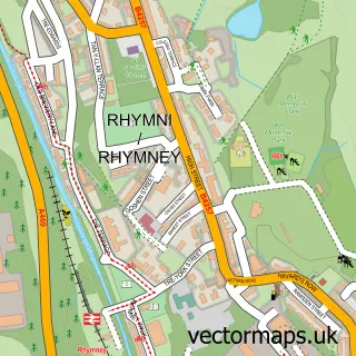
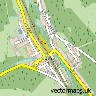
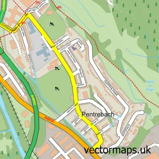
This Pontlottyn street map is a detailed vector street map covering a 750m x 750m area. Select a larger area to create and download your own vector street map of Pontlottyn.
The 750-metre map sample for Pontlottyn covers 211 mapped buildings and approximately 48.0 km of road detail, of which 27 named roads are named. The immediate area includes 1 railway station, 2 pubs and 4 MOT stations within 2 miles. The wider area around Pontlottyn features 2 food and drink venues. To create a larger or custom map of Pontlottyn, the map builder lets you define your own coverage area and download editable SVG, PDF and PNG files.
Create a larger editable map of Pontlottyn
Choose any area you need and generate a high-quality vector map instantly. Perfect for print, planning, design, business and personal use.

This Pontlottyn street map in Gwent is available as downloadable SVG, PDF and PNG map files, or as a printed map for planning, business, display, education, local information and design work. You can also create a larger custom map area using the map selector.
What this Pontlottyn map sample shows
Pontlottyn lies within Rhymney Community parish, part of Pontlottyn ward in the Caerffili - Caerphilly local authority area. The postcode geography for this area includes the CF postcode area, the CF81 postcode district and the CF81 9 postcode sector. Residents fall under the Aneurin Bevan University Health Board for NHS services.
Local features near Pontlottyn
Within 2 milesAmenities and services in and around Pontlottyn.
Administrative and postcode information for Pontlottyn
Pontlottyn lies within Rhymney Community parish, part of Pontlottyn ward in the Caerffili - Caerphilly local authority area. The postcode geography for this area includes the CF postcode area, the CF81 postcode district and the CF81 9 postcode sector. Residents fall under the Aneurin Bevan University Health Board for NHS services.
Nearby street map samples around Pontlottyn

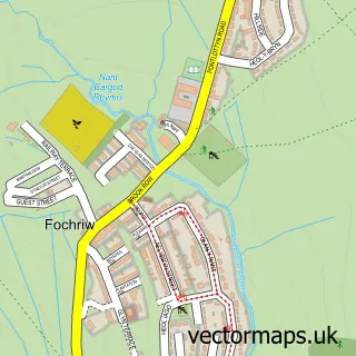
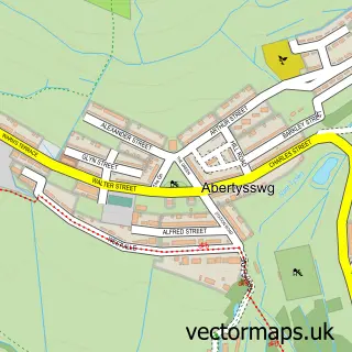
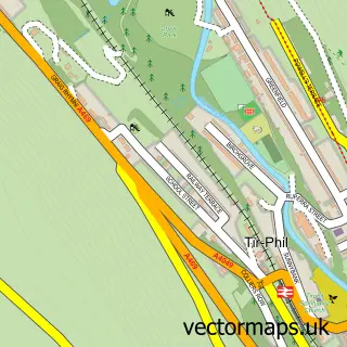
More street maps in Gwent
750 metre map area coverage
Boundary, postcode and point of interest information for the 750m x 750m rectangle centred on this sample map.
Boundaries containing map centre
Constituency: Blaenau Gwent and Rhymney Co Const
District: Caerffili - Caerphilly
Icb: Aneurin Bevan University
Parish: Rhymney Community
Police Force: gwent
Postcode District: CF81
Postcode Sector: CF81 9
Nearby boundaries intersecting sample
Postcode District: NP22
Postcode Sector: NP22 5
Postcode coverage
POI category counts
Convenience Store: 4
Atms: 2
Church Cathedral: 2
Elementary School: 2
Grocery Store: 2
Hair Salon: 2
Professional Services: 2
Pub: 2
Shipping Center: 2
Train Station: 2
Sample points of interest
- St Clares Sheltered Housing
- Christies Fayre (Nano), Pontlottyn
- PayPoint
- A1 Unique Upholstery
- Cutting CrewThe
- Studio 31
- Suspension inc.
- Brides of Elegance
- G Swan Roofing
- Action For Children
- The Gold Lion
- Elim Community Church, Pontlottyn
Create a larger editable map of Pontlottyn
This sample shows only a 750 metre area. To create a larger map of Pontlottyn, use our map builder to choose your own coverage area, add titles and download editable SVG, PDF and PNG files.
Create a custom map of Pontlottyn