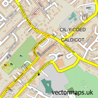
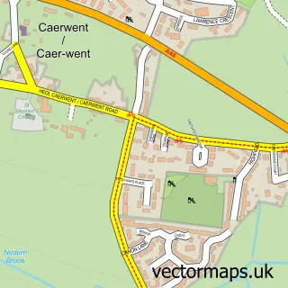
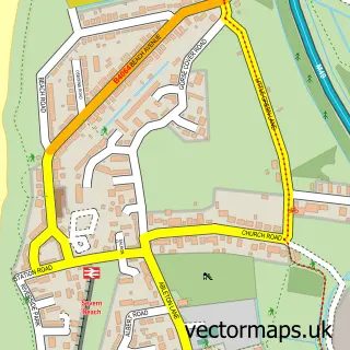
This Portskewett street map is a detailed vector street map covering a 750m x 750m area. Select a larger area to create and download your own vector street map of Portskewett.
The 750-metre map sample for Portskewett covers 334 mapped buildings and approximately 10.4 km of road detail, of which 16 named roads are named. The immediate area includes 1 school, 1 GP surgery, 2 pubs and 4 MOT stations within 2 miles. The wider area around Portskewett features 2 food and drink venues. To create a larger or custom map of Portskewett, the map builder lets you define your own coverage area and download editable SVG, PDF and PNG files.
Create a larger editable map of Portskewett
Choose any area you need and generate a high-quality vector map instantly. Perfect for print, planning, design, business and personal use.

This Portskewett street map in Gwent is available as downloadable SVG, PDF and PNG map files, or as a printed map for planning, business, display, education, local information and design work. You can also create a larger custom map area using the map selector.
What this Portskewett map sample shows
Portskewett lies within Portskewett Community parish, part of Portskewett ward in the Sir Fynwy - Monmouthshire local authority area. The postcode geography for this area includes the NP postcode area, the NP26 postcode district and the NP26 5 postcode sector. Residents fall under the Aneurin Bevan University Health Board for NHS services.
Local features near Portskewett
Within 2 milesAmenities and services in and around Portskewett.
Administrative and postcode information for Portskewett
The local authority covering Portskewett is Sir Fynwy - Monmouthshire, within the county of Gwent. The settlement lies within Portskewett ward and Portskewett Community civil parish. The NP26 postcode district and NP26 5 postcode sector serve the immediate area. NHS provision in the area is delivered through Aneurin Bevan University Health Board.
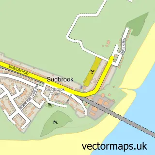
Nearby street map samples around Portskewett

More street maps in Gwent
750 metre map area coverage
Boundary, postcode and point of interest information for the 750m x 750m rectangle centred on this sample map.
Boundaries containing map centre
Constituency: Monmouthshire Co Const
District: Sir Fynwy - Monmouthshire
Icb: Aneurin Bevan University
Parish: Portskewett Community
Police Force: gwent
Postcode District: NP26
Postcode Sector: NP26 5
Nearby boundaries intersecting sample
No additional intersecting boundaries found.
Postcode coverage
POI category counts
Beauty Salon: 2
Community Center: 2
Convenience Store: 2
Doctor: 2
Pub: 2
Atms: 1
Bridal Shop: 1
Church Cathedral: 1
Counseling And Mental Health: 1
Dance School: 1
Sample points of interest
- PayPoint
- Dreadlocks and Broomsticks
- Hair Studio
- Simply Wed
- St Mary Portskewett Church
- Portskewett Church Hall.
- Portskewett and Sudbrook Recreation Hall
- Premier Portskewett Store
- SPAR
- HART Education and Wellbeing
- Sarah's Side Kicks
- Mount Pleasant Practice
Create a larger editable map of Portskewett
This sample shows only a 750 metre area. To create a larger map of Portskewett, use our map builder to choose your own coverage area, add titles and download editable SVG, PDF and PNG files.
Create a custom map of Portskewett