Vector Maps logo
Home Why it works Popular maps Districts Samples Customizer Create Your Map
VectorMaps.uk
Home Popular maps Districts Samples Customizer Create Your Map Privacy Disclaimer
Home / UK Maps / Aberdeenshire / Potterton Map

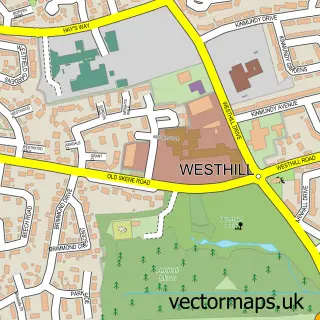
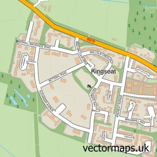
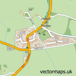
This Potterton street map is a detailed vector street map covering a 750m x 750m area. Select a larger area to create and download your own vector street map of Potterton.

Potterton is a village in Aberdeenshire, in the North East Scotland of Scotland. The settlement falls within the Gordon parliamentary constituency. It is served by the AB23 postcode district, with AB23 8 as the local postcode sector.

The 750-metre map sample for Potterton covers 223 mapped buildings and approximately 8.8 km of road detail, of which 8 named roads are named. The immediate area includes 1 MOT station within 2 miles. To create a larger or custom map of Potterton, the map builder lets you define your own coverage area and download editable SVG, PDF and PNG files.

223Buildings
8.8 kmRoads
8Named roads
0Residents within 2 miles
Create your own

Create a larger editable map of Potterton

Choose any area you need and generate a high-quality vector map instantly. Perfect for print, planning, design, business and personal use.

Choose any location
Editable SVG files
Any size up to A0
PDF, PNG & more
Instant download
High quality guaranteed
Create My Custom Map
Secure, private & no credit card required
Potterton Vector Street Map
750m Sample
Potterton vector street map sample showing roads, buildings and local features in a 750 metre preview area
Buy Potterton Map Print from £12.95 Buy Potterton Digital Map from £6

This Potterton street map in Aberdeenshire is available as downloadable SVG, PDF and PNG map files, or as a printed map for planning, business, display, education, local information and design work. You can also create a larger custom map area using the map selector.

What this Potterton map sample shows

Potterton lies within Aberdeenshire parish, part of Mid Formartine ward in the Aberdeenshire local authority area. The postcode geography for this area includes the AB postcode area, the AB23 postcode district and the AB23 8 postcode sector. Residents fall under the Grampian for NHS services.

Local features near Potterton

Within 2 miles

Amenities and services in and around Potterton.

1 MOT stations within 2 miles

Counts are approximate and based on publicly available data.

Administrative and postcode information for Potterton

The local authority covering Potterton is Aberdeenshire, within the county of Aberdeenshire. The settlement lies within Mid Formartine ward and Aberdeenshire civil parish. The AB23 postcode district and AB23 8 postcode sector serve the immediate area. NHS provision in the area is delivered through Grampian.

Parish ABERDEENSHIRE
Ward Mid Formartine
District / local authority Aberdeenshire
County Aberdeenshire
Historic county Aberdeenshire
Postcode district AB23
Postcode sector AB23 8
Parliamentary constituency Gordon
Region North East Scotland
Country Scotland

Nearby street map samples around Potterton

Street map sample of Westhill, Aberdeenshire Westhill Town - Aberdeenshire - 8.5 miles Street map sample of Aberdeen, City of Aberdeen Aberdeen City - City of Aberdeen - 5.7 miles Street map sample of Belhelvie, Aberdeenshire Belhelvie Village - Aberdeenshire - 1.3 miles Street map sample of Blackdog, Aberdeenshire Blackdog Village - Aberdeenshire - 1.5 miles Street map sample of Balmedie, Aberdeenshire Balmedie Village - Aberdeenshire - 2.0 miles Street map sample of Kingseat, Aberdeenshire Kingseat Village - Aberdeenshire - 3.1 miles Street map sample of Newmachar, Aberdeenshire Newmachar Village - Aberdeenshire - 4.2 miles Street map sample of Foveran, Aberdeenshire Foveran Village - Aberdeenshire - 5.5 miles Street map sample of Udny Station, Aberdeenshire Udny Station Village - Aberdeenshire - 5.9 miles Street map sample of Hatton of Fintray, Aberdeenshire Hatton of Fintray Village - Aberdeenshire - 6.1 miles

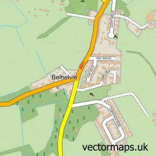
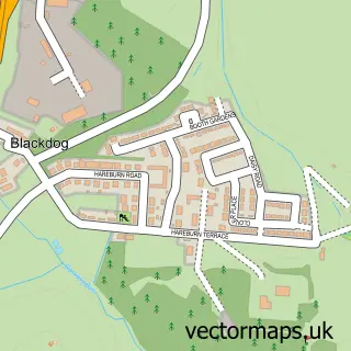
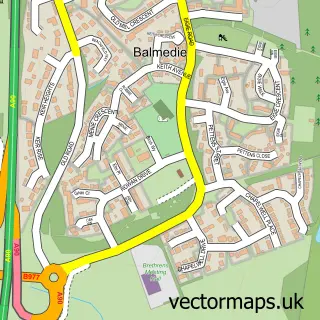
More street maps in Aberdeenshire

Street map sample of Belhelvie, Aberdeenshire Belhelvie Village - 1.3 miles Street map sample of Blackdog, Aberdeenshire Blackdog Village - 1.5 miles Street map sample of Balmedie, Aberdeenshire Balmedie Village - 2.0 miles Street map sample of Kingseat, Aberdeenshire Kingseat Village - 3.1 miles Street map sample of Newmachar, Aberdeenshire Newmachar Village - 4.2 miles

750 metre map area coverage

Boundary, postcode and point of interest information for the 750m x 750m rectangle centred on this sample map.

Boundaries containing map centre

Constituency: Gordon and Buchan Co Const

District: Aberdeenshire

Icb: Grampian

Postcode District: AB23

Postcode Sector: AB23 8

Ward: Mid Formartine Ward

Nearby boundaries intersecting sample

No additional intersecting boundaries found.

Postcode coverage

AB23 AB23 8

POI category counts

Home Goods Store: 2

Convenience Store: 1

Cupcake Shop: 1

Food Beverage Service Distribution: 1

Naturopathic Holistic: 1

Post Office: 1

Professional Services: 1

Shipping Center: 1

Sports Club And League: 1

Sample points of interest

  • Costcutter Convenience Store
  • Cupcakes by Nicki Cupcake Shop
  • W M Fraser Food Beverage Service Distribution
  • W B Jamieson Home Goods Store
  • WB Jamieson Ltd Home Goods Store
  • Sounds of Tsangpo Naturopathic Holistic
  • Post Office Post Office
  • Paul Cairns Art Professional Services
  • Potterton Post Office Shipping Center
  • Bow Fiddle Rock, Portknockie, Scotland Sports Club And League

Create a larger editable map of Potterton

This sample shows only a 750 metre area. To create a larger map of Potterton, use our map builder to choose your own coverage area, add titles and download editable SVG, PDF and PNG files.

Create a custom map of Potterton

Phone 01751 473136 | Copyright Vectormaps.uk 2026

Samples Customizer Privacy Disclaimer
Potterton Vector Street Map
Potterton enlarged street map sample showing a 750 metre preview area