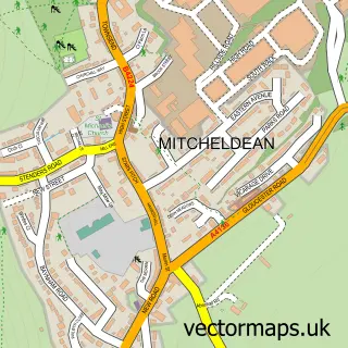
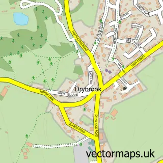
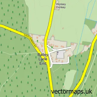
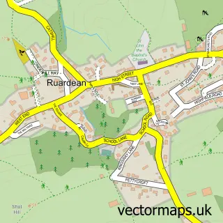
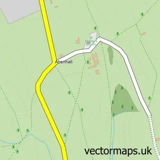
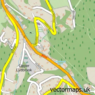
This Puddlebrook street map is a detailed vector street map covering a 750m x 750m area. Select a larger area to create and download your own vector street map of Puddlebrook.
The 750-metre map sample for Puddlebrook covers 102 mapped buildings and approximately 29.9 km of road detail, of which 5 named roads are named. The immediate area includes 2 GP surgeries within 2 miles and 5 MOT stations within 2 miles. The wider area around Puddlebrook features 3 tourism points of interest, 1 food and drink venue and 1 campsite within 2 miles. To create a larger or custom map of Puddlebrook, the map builder lets you define your own coverage area and download editable SVG, PDF and PNG files.
Create a larger editable map of Puddlebrook
Choose any area you need and generate a high-quality vector map instantly. Perfect for print, planning, design, business and personal use.

This Puddlebrook street map in Gloucestershire is available as downloadable SVG, PDF and PNG map files, or as a printed map for planning, business, display, education, local information and design work. You can also create a larger custom map area using the map selector.
What this Puddlebrook map sample shows
Puddlebrook lies within Drybrook Cp parish, part of Mitcheldean, Ruardean & Drybrook ward in the Forest Of Dean District local authority area. The postcode geography for this area includes the GL postcode area, the GL17 postcode district and the GL17 9 postcode sector. Residents fall under the Nhs Gloucestershire Integrated Care Board for NHS services.
Local features near Puddlebrook
Within 2 milesAmenities and services in and around Puddlebrook.
Administrative and postcode information for Puddlebrook
The local authority covering Puddlebrook is Forest Of Dean District, within the county of Gloucestershire. The settlement lies within Mitcheldean, Ruardean & Drybrook ward and Drybrook Cp civil parish. The GL17 postcode district and GL17 9 postcode sector serve the immediate area. NHS provision in the area is delivered through Gloucestershire Hospitals Nhs Foundation Trust.
Nearby street map samples around Puddlebrook

More street maps in Gloucestershire
750 metre map area coverage
Boundary, postcode and point of interest information for the 750m x 750m rectangle centred on this sample map.
Boundaries containing map centre
Constituency: Forest of Dean Co Const
County: Gloucestershire County
District: Forest of Dean District
Icb: NHS Gloucestershire ICB
Parish: Drybrook CP
Police Force: gloucestershire
Postcode District: GL17
Postcode Sector: GL17 9
Ward: Mitcheldean, Ruardean & Drybrook Ward
Nearby boundaries intersecting sample
Constituency: Hereford and South Herefordshire Co Const
District: County of Herefordshire
Icb: NHS Herefordshire and Worcestershire ICB
Parish: Hope Mansell CP, Mitcheldean CP
Police Force: west mercia
Postcode District: HR9
Postcode Sector: GL17 0, HR9 5
Ward: Penyard Ward
Postcode coverage
POI category counts
Campground: 2
Cafe: 1
Caterer: 1
Contractor: 1
Kids Recreation And Party: 1
National Park: 1
Retail: 1
Retirement Home: 1
Surgical Appliances And Supplies: 1
Sample points of interest
- Greenway Cafe
- Greenway Farm Campsite
- Greenways Farm Campsite
- Flamin Edges at The Yew Tree Longhope
- Cavendish Park Builders
- Greenway Cafe
- Puddlebrook Quarry
- Shire Garden Flowers
- Euroclydon Nursing and Residential Home
- Athrodax Healthcare
Create a larger editable map of Puddlebrook
This sample shows only a 750 metre area. To create a larger map of Puddlebrook, use our map builder to choose your own coverage area, add titles and download editable SVG, PDF and PNG files.
Create a custom map of Puddlebrook