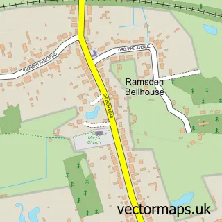
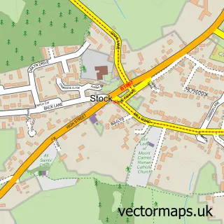
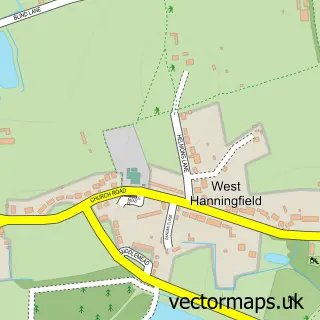
This Ramsden Heath street map is a detailed vector street map covering a 750m x 750m area. Select a larger area to create and download your own vector street map of Ramsden Heath.
The 750-metre map sample for Ramsden Heath covers 290 mapped buildings and approximately 9.4 km of road detail, of which 18 named roads are named. The immediate area includes 1 pub and 1 MOT station within 2 miles. The wider area around Ramsden Heath features 4 food and drink venues. To create a larger or custom map of Ramsden Heath, the map builder lets you define your own coverage area and download editable SVG, PDF and PNG files.
Create a larger editable map of Ramsden Heath
Choose any area you need and generate a high-quality vector map instantly. Perfect for print, planning, design, business and personal use.

This Ramsden Heath street map in Essex is available as downloadable SVG, PDF and PNG map files, or as a printed map for planning, business, display, education, local information and design work. You can also create a larger custom map area using the map selector.
What this Ramsden Heath map sample shows
Ramsden Heath lies within South Hanningfield Cp parish, part of South Hanningfield, Stock And Margaretting ward in the Chelmsford District (B) local authority area. The postcode geography for this area includes the CM postcode area, the CM11 postcode district and the CM11 1 postcode sector. Residents fall under the Nhs Mid And South Essex Integrated Care Board for NHS services.
Local features near Ramsden Heath
Within 2 milesAmenities and services in and around Ramsden Heath.
Administrative and postcode information for Ramsden Heath
The local authority covering Ramsden Heath is Chelmsford District (B), within the county of Essex. The settlement lies within South Hanningfield, Stock And Margaretting ward and South Hanningfield Cp civil parish. The CM11 postcode district and CM11 1 postcode sector serve the immediate area. NHS provision in the area is delivered through Mid And South Essex Nhs Foundation Trust.
Nearby street map samples around Ramsden Heath

More street maps in Essex
750 metre map area coverage
Boundary, postcode and point of interest information for the 750m x 750m rectangle centred on this sample map.
Boundaries containing map centre
Constituency: Maldon Co Const
County: Essex County
District: Chelmsford District (B)
Icb: NHS Essex ICB
Parish: South Hanningfield CP
Police Force: essex
Postcode District: CM11
Postcode Sector: CM11 1
Ward: South Hanningfield, Stock and Margaretting Ward
Nearby boundaries intersecting sample
No additional intersecting boundaries found.
Postcode coverage
POI category counts
Building Supply Store: 4
Advertising Agency: 2
Beauty Salon: 2
Cafe: 2
Preschool: 2
Appliance Manufacturer: 1
Automotive Repair: 1
Bar: 1
Beauty And Spa: 1
Carpenter: 1
Sample points of interest
- Clarity In Marketing Ltd
- chalk media
- PMF Fortuna
- DAS Automotive
- White Horse
- Brows By Andrea - Microblading In Billericay
- EC Beauty Ramsden Heath
- Forever Young Aesthetics Beauty & Skin Ltd
- Beach Comber Lighting
- CJ Broad Heating
- R H Tidnam Electrical Contractors
- RM Brickwork
Create a larger editable map of Ramsden Heath
This sample shows only a 750 metre area. To create a larger map of Ramsden Heath, use our map builder to choose your own coverage area, add titles and download editable SVG, PDF and PNG files.
Create a custom map of Ramsden Heath