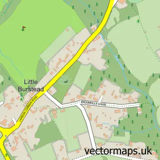
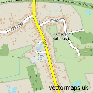
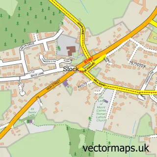
This Great Burstead street map is a detailed vector street map covering a 750m x 750m area. Select a larger area to create and download your own vector street map of Great Burstead.
The 750-metre map sample for Great Burstead covers 567 mapped buildings and approximately 16.5 km of road detail, of which 34 named roads are named. The immediate area includes 5 GP surgeries within 2 miles, 4 pubs and 14 MOT stations within 2 miles. The wider area around Great Burstead features 1 tourism point of interest and 4 food and drink venues. To create a larger or custom map of Great Burstead, the map builder lets you define your own coverage area and download editable SVG, PDF and PNG files.
Create a larger editable map of Great Burstead
Choose any area you need and generate a high-quality vector map instantly. Perfect for print, planning, design, business and personal use.

This Great Burstead street map in Essex is available as downloadable SVG, PDF and PNG map files, or as a printed map for planning, business, display, education, local information and design work. You can also create a larger custom map area using the map selector.
What this Great Burstead map sample shows
Great Burstead lies within Great Burstead And South Green Cp parish, part of Burstead ward in the Basildon District (B) local authority area. The postcode geography for this area includes the CM postcode area, the CM11 postcode district and the CM11 2 postcode sector. Residents fall under the Nhs Mid And South Essex Integrated Care Board for NHS services.
Local features near Great Burstead
Within 2 milesAmenities and services in and around Great Burstead.
Administrative and postcode information for Great Burstead
Great Burstead lies within Great Burstead And South Green Cp parish, part of Burstead ward in the Basildon District (B) local authority area. The postcode geography for this area includes the CM postcode area, the CM11 postcode district and the CM11 2 postcode sector. Residents fall under the Nhs Mid And South Essex Integrated Care Board for NHS services.
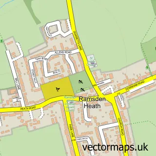
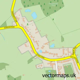
Nearby street map samples around Great Burstead

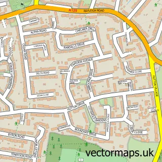
More street maps in Essex
750 metre map area coverage
Boundary, postcode and point of interest information for the 750m x 750m rectangle centred on this sample map.
Boundaries containing map centre
Constituency: Basildon and Billericay Boro Const
County: Essex County
District: Basildon District (B)
Icb: NHS Essex ICB
Parish: Great Burstead and South Green CP
Police Force: essex
Postcode District: CM11
Postcode Sector: CM11 2
Ward: Burstead Ward
Nearby boundaries intersecting sample
No additional intersecting boundaries found.
Postcode coverage
POI category counts
Professional Services: 4
Pub: 4
Gardener: 2
It Service And Computer Repair: 2
Metals: 2
Alternative Medicine: 1
Arts And Crafts: 1
Auto Company: 1
Auto Loan Provider: 1
Automation Services: 1
Sample points of interest
- Blue Skys
- The Urban Paint Company Ltd.
- Big Blue Detailing
- Vision Mortgage Brokers
- Absolute Door Services
- The Luxury Nail & Beauty Co
- A1 Private Hire
- The Urban Paint Company Limited
- HomeBakeyCakey
- Grange Green Dental Practice
- Walks With Allie
- AA Instructor Jim Ayres
Create a larger editable map of Great Burstead
This sample shows only a 750 metre area. To create a larger map of Great Burstead, use our map builder to choose your own coverage area, add titles and download editable SVG, PDF and PNG files.
Create a custom map of Great Burstead