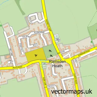
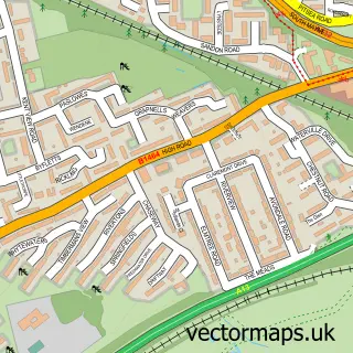
This Crays Hill street map is a detailed vector street map covering a 750m x 750m area. Select a larger area to create and download your own vector street map of Crays Hill.
The 750-metre map sample for Crays Hill covers 289 mapped buildings and approximately 7.4 km of road detail, of which 14 named roads are named. The immediate area includes 5 GP surgeries within 2 miles, 1 pub and 21 MOT stations within 2 miles. The wider area around Crays Hill features 1 food and drink venue. To create a larger or custom map of Crays Hill, the map builder lets you define your own coverage area and download editable SVG, PDF and PNG files.
Create a larger editable map of Crays Hill
Choose any area you need and generate a high-quality vector map instantly. Perfect for print, planning, design, business and personal use.

This Crays Hill street map in Essex is available as downloadable SVG, PDF and PNG map files, or as a printed map for planning, business, display, education, local information and design work. You can also create a larger custom map area using the map selector.
What this Crays Hill map sample shows
Crays Hill lies within Ramsden Crays Cp parish, part of Crouch ward in the Basildon District (B) local authority area. The postcode geography for this area includes the CM postcode area, the CM11 postcode district and the CM11 2 postcode sector. Residents fall under the Nhs Mid And South Essex Integrated Care Board for NHS services.
Local features near Crays Hill
Within 2 milesAmenities and services in and around Crays Hill.
Administrative and postcode information for Crays Hill
The local authority covering Crays Hill is Basildon District (B), within the county of Essex. The settlement lies within Crouch ward and Ramsden Crays Cp civil parish. The CM11 postcode district and CM11 2 postcode sector serve the immediate area. NHS provision in the area is delivered through Mid And South Essex Nhs Foundation Trust.
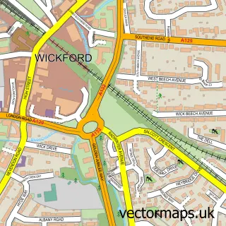
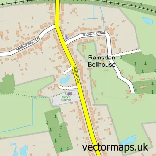
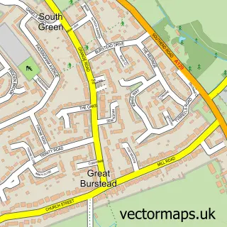
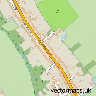
Nearby street map samples around Crays Hill

More street maps in Essex
750 metre map area coverage
Boundary, postcode and point of interest information for the 750m x 750m rectangle centred on this sample map.
Boundaries containing map centre
Constituency: Basildon and Billericay Boro Const
County: Essex County
District: Basildon District (B)
Icb: NHS Essex ICB
Parish: Ramsden Crays CP
Police Force: essex
Postcode District: CM11
Postcode Sector: CM11 2
Ward: Castledon & Crouch Ward
Nearby boundaries intersecting sample
No additional intersecting boundaries found.
Postcode coverage
POI category counts
Contractor: 3
Beauty Salon: 2
Shipping Center: 2
Beer Garden: 1
Building Supply Store: 1
Car Dealer: 1
Convenience Store: 1
Fountain: 1
Gardener: 1
Insurance Agency: 1
Sample points of interest
- AbBeauty
- Ultra Violet Parlour
- Shepherd and Dog
- Coverdale Landscaping
- Octane 77
- Aaron Paving Essex
- K C P Demolition
- KCP Demolition
- Premier
- Crays Hill
- Greensleeves Lawn Care
- GM Healthcare Solutions
Create a larger editable map of Crays Hill
This sample shows only a 750 metre area. To create a larger map of Crays Hill, use our map builder to choose your own coverage area, add titles and download editable SVG, PDF and PNG files.
Create a custom map of Crays Hill