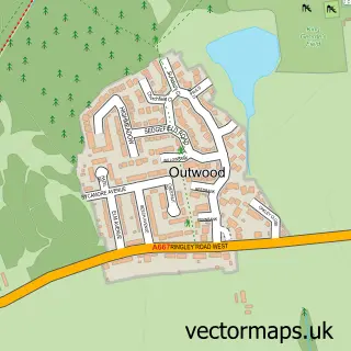
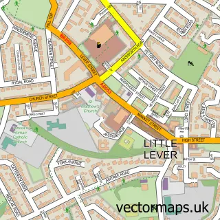
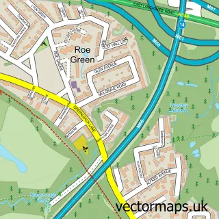
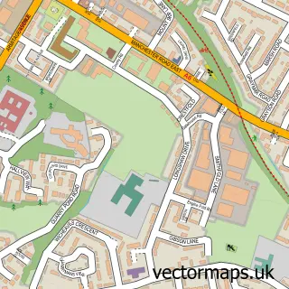
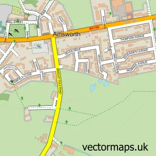
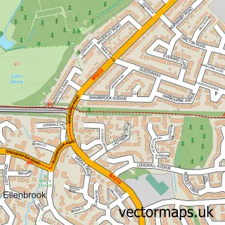
This Ringley street map is a detailed vector street map covering a 750m x 750m area. Select a larger area to create and download your own vector street map of Ringley.
The 750-metre map sample for Ringley covers 96 mapped buildings and approximately 9.6 km of road detail, of which 13 named roads are named. The immediate area includes 1 school, 10 GP surgeries within 2 miles, 1 pub and 25 MOT stations within 2 miles. The wider area around Ringley features 1 food and drink venue. To create a larger or custom map of Ringley, the map builder lets you define your own coverage area and download editable SVG, PDF and PNG files.
Create a larger editable map of Ringley
Choose any area you need and generate a high-quality vector map instantly. Perfect for print, planning, design, business and personal use.

This Ringley street map in Greater Manchester is available as downloadable SVG, PDF and PNG map files, or as a printed map for planning, business, display, education, local information and design work. You can also create a larger custom map area using the map selector.
What this Ringley map sample shows
Ringley lies within Bolton District (B) parish, part of Kearsley ward in the Bolton District (B) local authority area. The postcode geography for this area includes the BL postcode area, the BL4 postcode district and the BL4 8 postcode sector. Residents fall under the Nhs Greater Manchester Integrated Care Board for NHS services.
Local features near Ringley
Within 2 milesAmenities and services in and around Ringley.
Administrative and postcode information for Ringley
The local authority covering Ringley is Bolton District (B), within the county of Greater Manchester. The settlement lies within Kearsley ward and Bolton District (B) civil parish. The BL4 postcode district and BL4 8 postcode sector serve the immediate area. NHS provision in the area is delivered through Bolton Nhs Foundation Trust.
Nearby street map samples around Ringley

More street maps in Greater Manchester
750 metre map area coverage
Boundary, postcode and point of interest information for the 750m x 750m rectangle centred on this sample map.
Boundaries containing map centre
Constituency: Bolton South and Walkden Boro Const
District: Bolton District (B)
Icb: NHS Greater Manchester ICB
Police Force: greater manchester
Postcode District: M26
Postcode Sector: M26 1
Ward: Kearsley Ward
Nearby boundaries intersecting sample
No additional intersecting boundaries found.
Postcode coverage
POI category counts
Anglican Church: 1
Bridge: 1
Business Manufacturing And Supply: 1
Elementary School: 1
Italian Restaurant: 1
Monument: 1
Naturopathic Holistic: 1
Playground: 1
Pub: 1
Roofing: 1
Sample points of interest
- St Saviour's Church
- Ringley Bridge
- ITAC Adhesives
- St Saviour CE Primary School
- La Roma Restaurant
- Ringley Old Bridge
- Elements of Nutrition
- Hulme Road Playground
- The Horseshoe
- Delvemade Limited
- Bolton South with Farnworth - Phoenix Explorers
Create a larger editable map of Ringley
This sample shows only a 750 metre area. To create a larger map of Ringley, use our map builder to choose your own coverage area, add titles and download editable SVG, PDF and PNG files.
Create a custom map of Ringley