Vector Maps logo
Home Why it works Popular maps Districts Samples Customizer Create Your Map
VectorMaps.uk
Home Popular maps Districts Samples Customizer Create Your Map Privacy Disclaimer
Home / UK Maps / Greater Manchester / Outwood Map

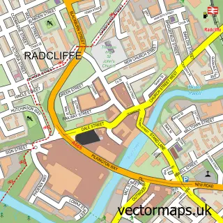
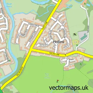
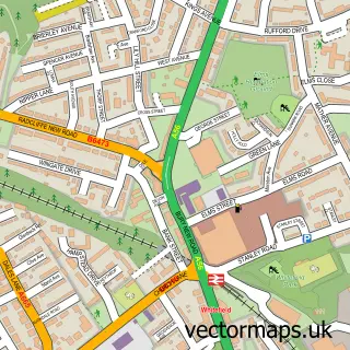
This Outwood street map is a detailed vector street map covering a 750m x 750m area. Select a larger area to create and download your own vector street map of Outwood.

Outwood is a village in Greater Manchester, in the North West of England. Historically, the area formed part of Lancashire. The settlement falls within the Bury South parliamentary constituency. It is served by the M26 postcode district, with M26 1 as the

The 750-metre map sample for Outwood covers 196 mapped buildings and approximately 6.2 km of road detail, of which 16 named roads are named. The immediate area includes 8 GP surgeries within 2 miles and 22 MOT stations within 2 miles. The wider area around Outwood features 1 tourism point of interest and 2 food and drink venues. To create a larger or custom map of Outwood, the map builder lets you define your own coverage area and download editable SVG, PDF and PNG files.

196Buildings
6.18 kmRoads
16Named roads
30,007Residents within 2 miles
Create your own

Create a larger editable map of Outwood

Choose any area you need and generate a high-quality vector map instantly. Perfect for print, planning, design, business and personal use.

Choose any location
Editable SVG files
Any size up to A0
PDF, PNG & more
Instant download
High quality guaranteed
Create My Custom Map
Secure, private & no credit card required
Outwood Vector Street Map
750m Sample
Outwood vector street map sample showing roads, buildings and local features in a 750 metre preview area
Buy Outwood Map Print from £12.95 Buy Outwood Digital Map from £6

This Outwood street map in Greater Manchester is available as downloadable SVG, PDF and PNG map files, or as a printed map for planning, business, display, education, local information and design work. You can also create a larger custom map area using the map selector.

What this Outwood map sample shows

Outwood lies within Bury District (B) parish, part of Radcliffe East ward in the Bury District (B) local authority area. The postcode geography for this area includes the M postcode area, the M26 postcode district and the M26 1 postcode sector. Residents fall under the Nhs Greater Manchester Integrated Care Board for NHS services.

Local features near Outwood

Within 2 miles

Amenities and services in and around Outwood.

8 GP surgeries within 2 miles
22 MOT stations within 2 miles
1 Tourism & leisure
2 Food & drink

Counts are approximate and based on publicly available data.

Administrative and postcode information for Outwood

The local authority covering Outwood is Bury District (B), within the county of Greater Manchester. The settlement lies within Radcliffe East ward and Bury District (B) civil parish. The M26 postcode district and M26 1 postcode sector serve the immediate area. NHS provision in the area is delivered through Bolton Nhs Foundation Trust.

Parish BURY DISTRICT (B)
Ward Radcliffe East
District / local authority Bury District (B)
County Greater Manchester
Historic county Lancashire
Postcode district M26
Postcode sector M26 1
Parliamentary constituency Bury South
Region North West
Country England

Nearby street map samples around Outwood

Street map sample of Radcliffe, Greater Manchester Radcliffe Town - Greater Manchester - 0.8 miles Street map sample of Salford, Greater Manchester Salford City - Greater Manchester - 4.6 miles Street map sample of Ringley, Greater Manchester Ringley Village - Greater Manchester - 1.0 miles Street map sample of Clifton, Greater Manchester Clifton Village - Greater Manchester - 1.5 miles Street map sample of Prestolee, Greater Manchester Prestolee Village - Greater Manchester - 1.6 miles Street map sample of Little Lever, Greater Manchester Little Lever Village - Greater Manchester - 1.8 miles Street map sample of Hollins, Greater Manchester Hollins Village - Greater Manchester - 2.4 miles Street map sample of Ainsworth, Greater Manchester Ainsworth Village - Greater Manchester - 2.7 miles Street map sample of Simister, Greater Manchester Simister Village - Greater Manchester - 3.1 miles Street map sample of Roe Green, Greater Manchester Roe Green Village - Greater Manchester - 3.2 miles

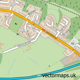
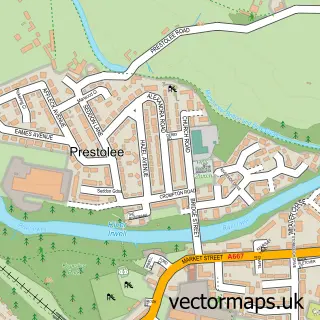
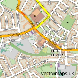
More street maps in Greater Manchester

Street map sample of Radcliffe, Greater Manchester Radcliffe Town - 0.8 miles Street map sample of Ringley, Greater Manchester Ringley Village - 1.0 miles Street map sample of Whitefield, Greater Manchester Whitefield Town - 1.5 miles Street map sample of Clifton, Greater Manchester Clifton Village - 1.5 miles Street map sample of Prestolee, Greater Manchester Prestolee Village - 1.6 miles

750 metre map area coverage

Boundary, postcode and point of interest information for the 750m x 750m rectangle centred on this sample map.

Boundaries containing map centre

Constituency: Bury South Boro Const

District: Bury District (B)

Icb: NHS Greater Manchester ICB

Police Force: greater manchester

Postcode District: M26

Postcode Sector: M26 1

Ward: Radcliffe West Ward

Nearby boundaries intersecting sample

Ward: Pilkington Park Ward

Postcode coverage

M26 M26 1

POI category counts

Bathroom Remodeling: 2

Coffee Shop: 2

Active Life: 1

Architect: 1

Auto Detailing: 1

Bike Repair Maintenance: 1

Building Contractor: 1

Construction Services: 1

Contractor: 1

Convenience Store: 1

Sample points of interest

  • Hilsden Farm Stables Active Life
  • C D Wilkinson Plans Architect
  • Showroom Detailing Auto Detailing
  • Lifestyle Blinds Bathroom Remodeling
  • O'Shea Bathrooms & Tiles Bathroom Remodeling
  • The Urban Cycle Centre CIC Bike Repair Maintenance
  • Fix N Fit Um Building Contractor
  • Branch 14 Coffee Bar Coffee Shop
  • Starbucks Coffee Shop
  • CDWP Construction Services
  • Garage Conversions Northwest Contractor
  • Ringley Stores Convenience Store

Create a larger editable map of Outwood

This sample shows only a 750 metre area. To create a larger map of Outwood, use our map builder to choose your own coverage area, add titles and download editable SVG, PDF and PNG files.

Create a custom map of Outwood

Phone 01751 473136 | Copyright Vectormaps.uk 2026

Samples Customizer Privacy Disclaimer
Outwood Vector Street Map
Outwood enlarged street map sample showing a 750 metre preview area