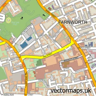
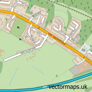
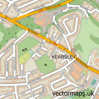
This Little Lever street map is a detailed vector street map covering a 750m x 750m area. Select a larger area to create and download your own vector street map of Little Lever.
The 750-metre map sample for Little Lever covers 560 mapped buildings and approximately 20.2 km of road detail, of which 61 named roads are named. The immediate area includes 3 schools, 3 GP surgeries, with 11 within 2 miles, 3 pubs and 1 MOT station, with 35 within 2 miles. The wider area around Little Lever features 10 food and drink venues. To create a larger or custom map of Little Lever, the map builder lets you define your own coverage area and download editable SVG, PDF and PNG files.
Create a larger editable map of Little Lever
Choose any area you need and generate a high-quality vector map instantly. Perfect for print, planning, design, business and personal use.

This Little Lever street map in Greater Manchester is available as downloadable SVG, PDF and PNG map files, or as a printed map for planning, business, display, education, local information and design work. You can also create a larger custom map area using the map selector.
What this Little Lever map sample shows
Little Lever lies within Bolton District (B) parish, part of Little Lever And Darcy Lever ward in the Bolton District (B) local authority area. The postcode geography for this area includes the BL postcode area, the BL3 postcode district and the BL3 1 postcode sector. Residents fall under the Nhs Greater Manchester Integrated Care Board for NHS services.
Local features near Little Lever
Within 2 milesAmenities and services in and around Little Lever.
Administrative and postcode information for Little Lever
The local authority covering Little Lever is Bolton District (B), within the county of Greater Manchester. The settlement lies within Little Lever And Darcy Lever ward and Bolton District (B) civil parish. The BL3 postcode district and BL3 1 postcode sector serve the immediate area. NHS provision in the area is delivered through Bolton Nhs Foundation Trust.
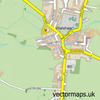
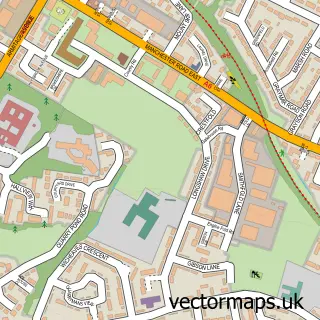
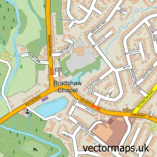
Nearby street map samples around Little Lever


More street maps in Greater Manchester
750 metre map area coverage
Boundary, postcode and point of interest information for the 750m x 750m rectangle centred on this sample map.
Boundaries containing map centre
Constituency: Bolton North East Boro Const
District: Bolton District (B)
Icb: NHS Greater Manchester ICB
Police Force: greater manchester
Postcode District: BL3
Postcode Sector: BL3 1
Ward: Little Lever & Darcy Lever Ward
Nearby boundaries intersecting sample
No additional intersecting boundaries found.
Postcode coverage
POI category counts
Barber: 5
Beauty Salon: 4
Cafe: 4
Church Cathedral: 4
General Dentistry: 4
Hair Salon: 4
Home Service: 4
Preschool: 4
Building Supply Store: 3
Coffee Shop: 3
Sample points of interest
- Mytham Pk Bowling Green
- The Best of Bolton
- St Matthew's Church
- ATM (Post Office)
- Jendahart Garage Services
- Mark Anthony Motors
- D & M Motors
- RBS
- Era Barbers
- Mens Room Barbershop
- Nimo's Barber Shop
- Nimo's Barbers
Create a larger editable map of Little Lever
This sample shows only a 750 metre area. To create a larger map of Little Lever, use our map builder to choose your own coverage area, add titles and download editable SVG, PDF and PNG files.
Create a custom map of Little Lever