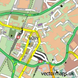
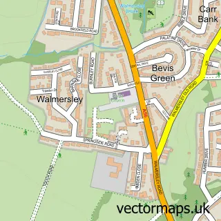
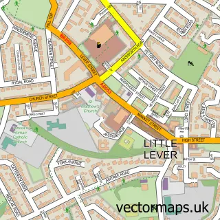
This Walshaw street map is a detailed vector street map covering a 750m x 750m area. Select a larger area to create and download your own vector street map of Walshaw.
The 750-metre map sample for Walshaw covers 171 mapped buildings and approximately 10.5 km of road detail, of which 26 named roads are named. The immediate area includes 1 school, 7 GP surgeries within 2 miles, 3 pubs and 13 MOT stations within 2 miles. The wider area around Walshaw features 6 food and drink venues. To create a larger or custom map of Walshaw, the map builder lets you define your own coverage area and download editable SVG, PDF and PNG files.
Create a larger editable map of Walshaw
Choose any area you need and generate a high-quality vector map instantly. Perfect for print, planning, design, business and personal use.

This Walshaw street map in Greater Manchester is available as downloadable SVG, PDF and PNG map files, or as a printed map for planning, business, display, education, local information and design work. You can also create a larger custom map area using the map selector.
What this Walshaw map sample shows
Walshaw lies within Bury District (B) parish, part of Tottington ward in the Bury District (B) local authority area. The postcode geography for this area includes the BL postcode area, the BL8 postcode district and the BL8 3 postcode sector. Residents fall under the Nhs Greater Manchester Integrated Care Board for NHS services.
Local features near Walshaw
Within 2 milesAmenities and services in and around Walshaw.
Administrative and postcode information for Walshaw
The local authority covering Walshaw is Bury District (B), within the county of Greater Manchester. The settlement lies within Tottington ward and Bury District (B) civil parish. The BL8 postcode district and BL8 3 postcode sector serve the immediate area. NHS provision in the area is delivered through Bolton Nhs Foundation Trust.
Nearby street map samples around Walshaw

More street maps in Greater Manchester
750 metre map area coverage
Boundary, postcode and point of interest information for the 750m x 750m rectangle centred on this sample map.
Boundaries containing map centre
Constituency: Bury North Boro Const
District: Bury District (B)
Icb: NHS Greater Manchester ICB
Police Force: greater manchester
Postcode District: BL8
Postcode Sector: BL8 3
Ward: Tottington Ward
Nearby boundaries intersecting sample
Ward: Bury West Ward
Postcode coverage
POI category counts
Beauty Salon: 3
Pub: 3
Bakery: 2
Church Cathedral: 2
Liquor Store: 2
Restaurant: 2
Wholesale Store: 2
Automobile Leasing: 1
Bar: 1
British Restaurant: 1
Sample points of interest
- 360 Vehicle Management Ltd
- Debbra Jane Cakes
- Debbra Janes Cupcakes Bury
- Cosalea Cafe Bars & Caterers
- Hair Solutions
- Hair by Olivia
- Revival Hairdressers Bury
- Walshaw Chippy
- Uap
- Totally Typing
- James’ cafe
- Bury Lions Club
Create a larger editable map of Walshaw
This sample shows only a 750 metre area. To create a larger map of Walshaw, use our map builder to choose your own coverage area, add titles and download editable SVG, PDF and PNG files.
Create a custom map of Walshaw