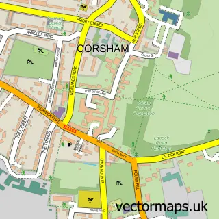
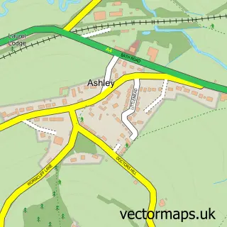
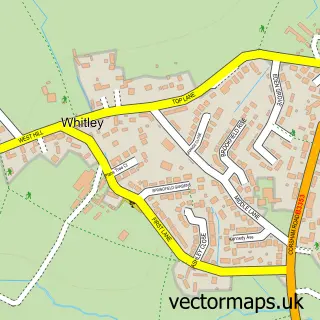
This Rudloe street map is a detailed vector street map covering a 750m x 750m area. Select a larger area to create and download your own vector street map of Rudloe.
The 750-metre map sample for Rudloe covers 226 mapped buildings and approximately 16.0 km of road detail, of which 25 named roads are named. The immediate area includes 2 GP surgeries within 2 miles, 1 pub and 1 MOT station, with 8 within 2 miles. The wider area around Rudloe features 4 food and drink venues. To create a larger or custom map of Rudloe, the map builder lets you define your own coverage area and download editable SVG, PDF and PNG files.
Create a larger editable map of Rudloe
Choose any area you need and generate a high-quality vector map instantly. Perfect for print, planning, design, business and personal use.

This Rudloe street map in Wiltshire is available as downloadable SVG, PDF and PNG map files, or as a printed map for planning, business, display, education, local information and design work. You can also create a larger custom map area using the map selector.
What this Rudloe map sample shows
Rudloe lies within Corsham Cp parish, part of Corsham Without And Box Hill ward in the Wiltshire local authority area. The postcode geography for this area includes the SN postcode area, the SN13 postcode district and the SN13 9 postcode sector. Residents fall under the Nhs Bath And North East Somerset, Swindon And Wiltshire Integrated Care Board for NHS services.
Local features near Rudloe
Within 2 milesAmenities and services in and around Rudloe.
Administrative and postcode information for Rudloe
Rudloe lies within Corsham Cp parish, part of Corsham Without And Box Hill ward in the Wiltshire local authority area. The postcode geography for this area includes the SN postcode area, the SN13 postcode district and the SN13 9 postcode sector. Residents fall under the Nhs Bath And North East Somerset, Swindon And Wiltshire Integrated Care Board for NHS services.
Nearby street map samples around Rudloe

More street maps in Wiltshire
750 metre map area coverage
Boundary, postcode and point of interest information for the 750m x 750m rectangle centred on this sample map.
Boundaries containing map centre
Constituency: Chippenham Co Const
District: Wiltshire
Icb: NHS Bath and North East Somerset Swindon and Wiltshire ICB
Parish: Box CP
Police Force: wiltshire
Postcode District: SN13
Postcode Sector: SN13 0
Nearby boundaries intersecting sample
Parish: Corsham CP
Postcode Sector: SN13 9
Postcode coverage
POI category counts
Building Supply Store: 2
Coffee Shop: 2
Community Center: 2
Preschool: 2
Auto Customization: 1
Automotive: 1
Automotive Repair: 1
B2b Science And Technology: 1
Beauty Salon: 1
Church Cathedral: 1
Sample points of interest
- Raceline
- Smiths Vehicle Repairs
- Phil Smith Vehicle Repairs
- Pearly Gates & Railings
- Little Beauty Room
- Flooring Unlimited
- NM Jones Plant and Groundworks
- Church on the Green
- Dandelion Coffee House
- Dandelion Coffee House
- Corsham Community Centre
- Rudloe Community Centre
Create a larger editable map of Rudloe
This sample shows only a 750 metre area. To create a larger map of Rudloe, use our map builder to choose your own coverage area, add titles and download editable SVG, PDF and PNG files.
Create a custom map of Rudloe