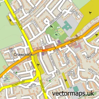
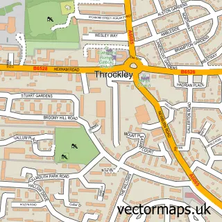
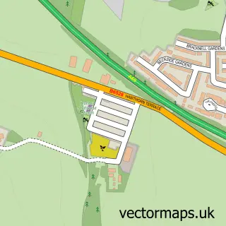
This Ryton street map is a detailed vector street map covering a 750m x 750m area. Select a larger area to create and download your own vector street map of Ryton.
The 750-metre map sample for Ryton covers 454 mapped buildings and approximately 21.6 km of road detail, of which 44 named roads are named. The immediate area includes 5 GP surgeries within 2 miles, 1 pub and 1 MOT station, with 16 within 2 miles. The wider area around Ryton features 1 tourism point of interest and 3 food and drink venues. To create a larger or custom map of Ryton, the map builder lets you define your own coverage area and download editable SVG, PDF and PNG files.
Create a larger editable map of Ryton
Choose any area you need and generate a high-quality vector map instantly. Perfect for print, planning, design, business and personal use.

This Ryton street map in Tyne & Wear is available as downloadable SVG, PDF and PNG map files, or as a printed map for planning, business, display, education, local information and design work. You can also create a larger custom map area using the map selector.
What this Ryton map sample shows
Ryton lies within Gateshead District (B) parish, part of Ryton, Crookhill And Stella ward in the Gateshead District (B) local authority area. The postcode geography for this area includes the NE postcode area, the NE40 postcode district and the NE40 3 postcode sector. Residents fall under the Nhs North East And North Cumbria Integrated Care Board for NHS services.
Local features near Ryton
Within 2 milesAmenities and services in and around Ryton.
Administrative and postcode information for Ryton
Ryton lies within Gateshead District (B) parish, part of Ryton, Crookhill And Stella ward in the Gateshead District (B) local authority area. The postcode geography for this area includes the NE postcode area, the NE40 postcode district and the NE40 3 postcode sector. Residents fall under the Nhs North East And North Cumbria Integrated Care Board for NHS services.
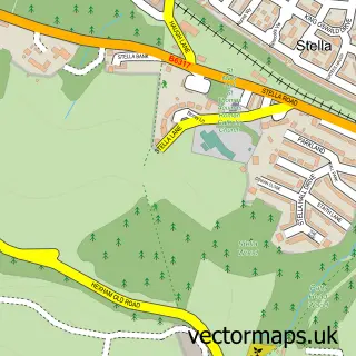
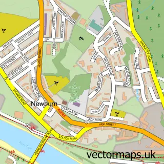
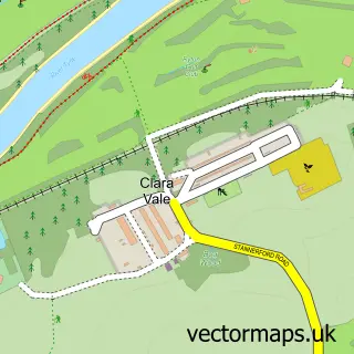
Nearby street map samples around Ryton

More street maps in Tyne & Wear
750 metre map area coverage
Boundary, postcode and point of interest information for the 750m x 750m rectangle centred on this sample map.
Boundaries containing map centre
Constituency: Blaydon and Consett Co Const
District: Gateshead District (B)
Icb: NHS North East and North Cumbria ICB
Police Force: northumberland
Postcode District: NE40
Postcode Sector: NE40 3
Ward: Ryton, Crookhill and Stella Ward
Nearby boundaries intersecting sample
No additional intersecting boundaries found.
Postcode coverage
POI category counts
Beauty Salon: 4
Dentist: 3
Antique Store: 2
Beauty And Spa: 2
Church Cathedral: 2
Doctor: 2
Hair Salon: 2
Korean Grocery Store: 2
Post Office: 2
Rental Kiosks: 2
Sample points of interest
- B Frank & Son
- Frank B & Son
- Norland Hobbies
- The Cooperative Food (BF) Ryton - Parsons Drive
- Jeff's Barbers
- Hair by Liz Graham
- Suki Hairdressing
- Blossom Beauty Co
- Body Sculpt Aesthetics
- Highcroft Aesthetics
- Vanity brows & beauty
- Betfred
Create a larger editable map of Ryton
This sample shows only a 750 metre area. To create a larger map of Ryton, use our map builder to choose your own coverage area, add titles and download editable SVG, PDF and PNG files.
Create a custom map of Ryton