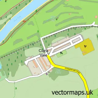
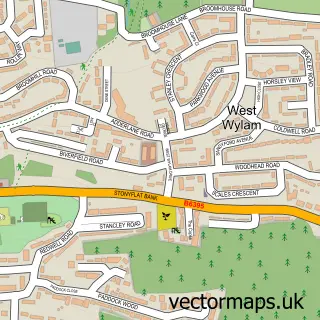
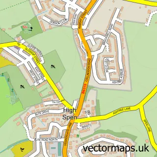
This Crawcrook street map is a detailed vector street map covering a 750m x 750m area. Select a larger area to create and download your own vector street map of Crawcrook.
The 750-metre map sample for Crawcrook covers 496 mapped buildings and approximately 23.7 km of road detail, of which 34 named roads are named. The immediate area includes 2 schools, 1 GP surgery, 4 pubs and 1 MOT station, with 4 within 2 miles. The wider area around Crawcrook features 2 tourism points of interest and 6 food and drink venues. To create a larger or custom map of Crawcrook, the map builder lets you define your own coverage area and download editable SVG, PDF and PNG files.
Create a larger editable map of Crawcrook
Choose any area you need and generate a high-quality vector map instantly. Perfect for print, planning, design, business and personal use.

This Crawcrook street map in Tyne & Wear is available as downloadable SVG, PDF and PNG map files, or as a printed map for planning, business, display, education, local information and design work. You can also create a larger custom map area using the map selector.
What this Crawcrook map sample shows
Crawcrook lies within Gateshead District (B) parish, part of Crawcrook And Greenside ward in the Gateshead District (B) local authority area. The postcode geography for this area includes the NE postcode area, the NE40 postcode district and the NE40 4 postcode sector. Residents fall under the Nhs North East And North Cumbria Integrated Care Board for NHS services.
Local features near Crawcrook
Within 2 milesAmenities and services in and around Crawcrook.
Administrative and postcode information for Crawcrook
The local authority covering Crawcrook is Gateshead District (B), within the county of Tyne & Wear. The settlement lies within Crawcrook And Greenside ward and Gateshead District (B) civil parish. The NE40 postcode district and NE40 4 postcode sector serve the immediate area. NHS provision in the area is delivered through Gateshead Health Nhs Foundation Trust.
Nearby street map samples around Crawcrook

More street maps in Tyne & Wear
750 metre map area coverage
Boundary, postcode and point of interest information for the 750m x 750m rectangle centred on this sample map.
Boundaries containing map centre
Constituency: Blaydon and Consett Co Const
District: Gateshead District (B)
Icb: NHS North East and North Cumbria ICB
Police Force: northumberland
Postcode District: NE40
Postcode Sector: NE40 4
Ward: Crawcrook and Greenside Ward
Nearby boundaries intersecting sample
Postcode Sector: NE40 3
Postcode coverage
POI category counts
Gas Station: 7
Barber: 5
Beauty Salon: 5
Real Estate Agent: 5
Automotive Repair: 4
Church Cathedral: 4
Pub: 4
Beauty And Spa: 3
Elementary School: 3
Hair Salon: 3
Sample points of interest
- Lindisfarne Care Home
- Rontec - Crawcrook (Co-op), Crawcrook
- E.C.S Electricals
- Barmoor MOT & Repairs
- Cool Car Air Conditioning
- Globe Garage
- Westburn Service Station
- Shirazi Repair
- Lloyds Bank
- 5 Star Barber
- Crawcrutz
- Crawcutz Gents Barber Shop
Create a larger editable map of Crawcrook
This sample shows only a 750 metre area. To create a larger map of Crawcrook, use our map builder to choose your own coverage area, add titles and download editable SVG, PDF and PNG files.
Create a custom map of Crawcrook