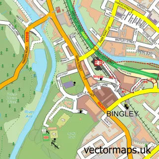
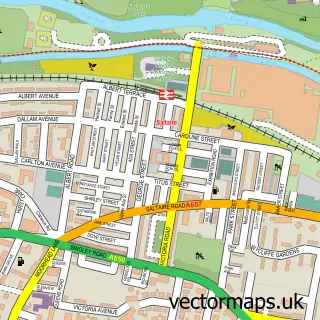
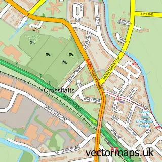
This Sandy Lane street map is a detailed vector street map covering a 750m x 750m area. Select a larger area to create and download your own vector street map of Sandy Lane.
The 750-metre map sample for Sandy Lane covers 279 mapped buildings and approximately 12.3 km of road detail, of which 28 named roads are named. The immediate area includes 1 school, 2 GP surgeries within 2 miles, 2 pubs and 1 MOT station, with 6 within 2 miles. The wider area around Sandy Lane features 1 tourism point of interest and 2 food and drink venues. To create a larger or custom map of Sandy Lane, the map builder lets you define your own coverage area and download editable SVG, PDF and PNG files.
Create a larger editable map of Sandy Lane
Choose any area you need and generate a high-quality vector map instantly. Perfect for print, planning, design, business and personal use.

This Sandy Lane street map in West Yorkshire is available as downloadable SVG, PDF and PNG map files, or as a printed map for planning, business, display, education, local information and design work. You can also create a larger custom map area using the map selector.
What this Sandy Lane map sample shows
Sandy Lane lies within Wilsden Cp parish, part of Bingley Rural ward in the Bradford District (B) local authority area. The postcode geography for this area includes the BD postcode area, the BD15 postcode district and the BD15 0 postcode sector. Residents fall under the Nhs West Yorkshire Integrated Care Board for NHS services.
Local features near Sandy Lane
Within 2 milesAmenities and services in and around Sandy Lane.
Administrative and postcode information for Sandy Lane
Sandy Lane lies within Wilsden Cp parish, part of Bingley Rural ward in the Bradford District (B) local authority area. The postcode geography for this area includes the BD postcode area, the BD15 postcode district and the BD15 0 postcode sector. Residents fall under the Nhs West Yorkshire Integrated Care Board for NHS services.
Nearby street map samples around Sandy Lane

More street maps in West Yorkshire
750 metre map area coverage
Boundary, postcode and point of interest information for the 750m x 750m rectangle centred on this sample map.
Boundaries containing map centre
Constituency: Bradford West Boro Const
District: Bradford District (B)
Icb: NHS West Yorkshire ICB
Parish: Sandy Lane CP
Police Force: west yorkshire
Postcode District: BD15
Postcode Sector: BD15 9
Ward: Thornton and Allerton Ward
Nearby boundaries intersecting sample
Constituency: Shipley Co Const
Parish: Bingley CP
Postcode District: BD16
Postcode Sector: BD16 1
Ward: Bingley Rural Ward, Heaton Ward
Postcode coverage
POI category counts
Beauty Salon: 3
Building Supply Store: 2
Chimney Sweep: 2
Pet Groomer: 2
Pub: 2
Accommodation: 1
Business Records Storage And Management: 1
Car Dealer: 1
Childrens Clothing Store: 1
Elementary School: 1
Sample points of interest
- Burnsdale
- Beau Hair and Beauty Specialists
- Diamond Cuts
- Perfect Touch
- Creative Desire Yorkshire
- Imagine
- Data Bubble Consultancy Ltd.
- Neon Motor Company
- Shirbar Exclusive
- Four Seasons Chimney Sweep
- Four Seasons Chimney Sweeps
- Sandy Lane Primary School
Create a larger editable map of Sandy Lane
This sample shows only a 750 metre area. To create a larger map of Sandy Lane, use our map builder to choose your own coverage area, add titles and download editable SVG, PDF and PNG files.
Create a custom map of Sandy Lane