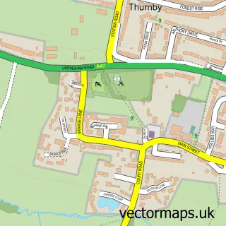
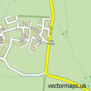
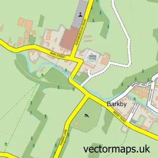
This Scraptoft street map is a detailed vector street map covering a 750m x 750m area. Select a larger area to create and download your own vector street map of Scraptoft.
The 750-metre map sample for Scraptoft covers 344 mapped buildings and approximately 21.8 km of road detail, of which 34 named roads are named. The immediate area includes 5 GP surgeries within 2 miles, 2 pubs and 10 MOT stations within 2 miles. The wider area around Scraptoft features 2 food and drink venues. To create a larger or custom map of Scraptoft, the map builder lets you define your own coverage area and download editable SVG, PDF and PNG files.
Create a larger editable map of Scraptoft
Choose any area you need and generate a high-quality vector map instantly. Perfect for print, planning, design, business and personal use.

This Scraptoft street map in Leicestershire is available as downloadable SVG, PDF and PNG map files, or as a printed map for planning, business, display, education, local information and design work. You can also create a larger custom map area using the map selector.
What this Scraptoft map sample shows
Scraptoft lies within Scraptoft Cp parish, part of Thurnby & Houghton ward in the Harborough District local authority area. The postcode geography for this area includes the LE postcode area, the LE7 postcode district and the LE7 9 postcode sector. Residents fall under the Nhs Leicester, Leicestershire And Rutland Integrated Care Board for NHS services.
Local features near Scraptoft
Within 2 milesAmenities and services in and around Scraptoft.
Administrative and postcode information for Scraptoft
Scraptoft lies within Scraptoft Cp parish, part of Thurnby & Houghton ward in the Harborough District local authority area. The postcode geography for this area includes the LE postcode area, the LE7 postcode district and the LE7 9 postcode sector. Residents fall under the Nhs Leicester, Leicestershire And Rutland Integrated Care Board for NHS services.
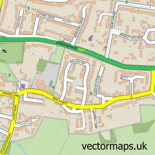
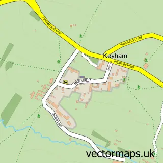
Nearby street map samples around Scraptoft

More street maps in Leicestershire
750 metre map area coverage
Boundary, postcode and point of interest information for the 750m x 750m rectangle centred on this sample map.
Boundaries containing map centre
Constituency: Rutland and Stamford Co Const
County: Leicestershire County
District: Harborough District
Icb: NHS Leicester Leicestershire and Rutland ICB
Parish: Scraptoft CP
Police Force: leicestershire
Postcode District: LE7
Postcode Sector: LE7 9
Ward: Thurnby & Houghton Ward
Nearby boundaries intersecting sample
Constituency: Leicester East Boro Const
District: City of Leicester (B)
Postcode District: LE5
Postcode Sector: LE5 1, LE5 2
Ward: Humberstone & Hamilton Ward, Thurncourt Ward
Postcode coverage
POI category counts
Anglican Church: 2
Automotive Repair: 2
Building Supply Store: 2
Garbage Collection Service: 2
Pest Control Service: 2
Pub: 2
Shipping Center: 2
Supermarket: 2
Appliance Manufacturer: 1
Art Gallery: 1
Sample points of interest
- All Saints Church, Scraptoft
- Scraptoft: All Saints
- Ima UK
- Ricky Joyce Artist
- Central England Co-Op - Scraptoft (SWAP), Scraptoft
- BBM Garage
- Built by Mike
- Big shak mobile barber
- CCT Roofing
- The Junk People
- House Clearance Leicester
- Scraptoft Campus - Leicester Poly
Create a larger editable map of Scraptoft
This sample shows only a 750 metre area. To create a larger map of Scraptoft, use our map builder to choose your own coverage area, add titles and download editable SVG, PDF and PNG files.
Create a custom map of Scraptoft