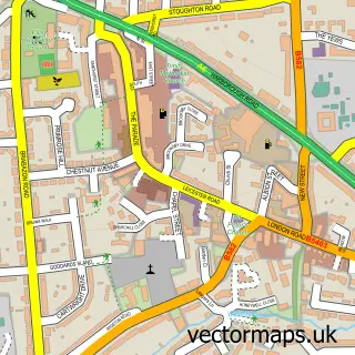
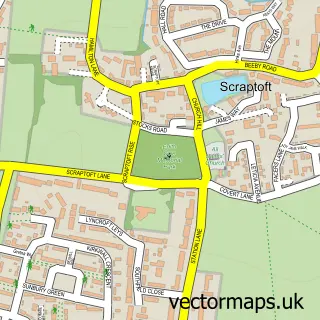
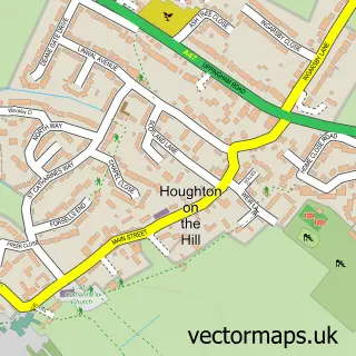
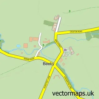
This Thurnby street map is a detailed vector street map covering a 750m x 750m area. Select a larger area to create and download your own vector street map of Thurnby.
The 750-metre map sample for Thurnby covers 257 mapped buildings and approximately 18.0 km of road detail, of which 20 named roads are named. The immediate area includes 1 school, 4 GP surgeries within 2 miles, 2 pubs and 8 MOT stations within 2 miles. The wider area around Thurnby features 3 food and drink venues. To create a larger or custom map of Thurnby, the map builder lets you define your own coverage area and download editable SVG, PDF and PNG files.
Create a larger editable map of Thurnby
Choose any area you need and generate a high-quality vector map instantly. Perfect for print, planning, design, business and personal use.

This Thurnby street map in Leicestershire is available as downloadable SVG, PDF and PNG map files, or as a printed map for planning, business, display, education, local information and design work. You can also create a larger custom map area using the map selector.
What this Thurnby map sample shows
Thurnby lies within Thurnby And Bushby Cp parish, part of Thurnby & Houghton ward in the Harborough District local authority area. The postcode geography for this area includes the LE postcode area, the LE7 postcode district and the LE7 9 postcode sector. Residents fall under the Nhs Leicester, Leicestershire And Rutland Integrated Care Board for NHS services.
Local features near Thurnby
Within 2 milesAmenities and services in and around Thurnby.
Administrative and postcode information for Thurnby
The local authority covering Thurnby is Harborough District, within the county of Leicestershire. The settlement lies within Thurnby & Houghton ward and Thurnby And Bushby Cp civil parish. The LE7 postcode district and LE7 9 postcode sector serve the immediate area. NHS provision in the area is delivered through University Hospitals Of Leicester Nhs Trust.
Nearby street map samples around Thurnby

More street maps in Leicestershire
750 metre map area coverage
Boundary, postcode and point of interest information for the 750m x 750m rectangle centred on this sample map.
Boundaries containing map centre
Constituency: Rutland and Stamford Co Const
County: Leicestershire County
District: Harborough District
Icb: NHS Leicester Leicestershire and Rutland ICB
Parish: Thurnby and Bushby CP
Police Force: leicestershire
Postcode District: LE7
Postcode Sector: LE7 9
Ward: Thurnby & Houghton Ward
Nearby boundaries intersecting sample
No additional intersecting boundaries found.
Postcode coverage
POI category counts
Medical Center: 2
Nursery And Gardening: 2
Pub: 2
Anglican Church: 1
Assisted Living Facility: 1
Automotive Repair: 1
Bar: 1
Building Contractor: 1
Cafe: 1
Car Dealer: 1
Sample points of interest
- St Luke's, Thurnby
- The Lodge Residential Home
- The Lion Garage
- The Swallow
- EMC Builders
- Cafe Fifty Five
- Vans For Sale
- Thurnby Village Childcare
- Thurnby Church
- Thurnby Scout and Guide HQ
- Co-op
- The Association for Psychological Therapies
Create a larger editable map of Thurnby
This sample shows only a 750 metre area. To create a larger map of Thurnby, use our map builder to choose your own coverage area, add titles and download editable SVG, PDF and PNG files.
Create a custom map of Thurnby