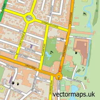
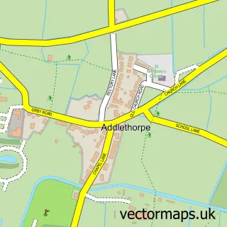
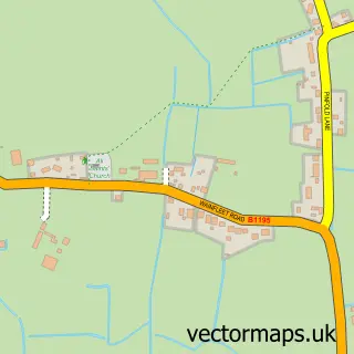
This Seacroft street map is a detailed vector street map covering a 750m x 750m area. Select a larger area to create and download your own vector street map of Seacroft.
The 750-metre map sample for Seacroft covers 240 mapped buildings and approximately 7.7 km of road detail, of which 15 named roads are named. The immediate area includes 1 GP surgery within 2 miles and 10 MOT stations within 2 miles. The wider area around Seacroft features 2 hotels. To create a larger or custom map of Seacroft, the map builder lets you define your own coverage area and download editable SVG, PDF and PNG files.
Create a larger editable map of Seacroft
Choose any area you need and generate a high-quality vector map instantly. Perfect for print, planning, design, business and personal use.

This Seacroft street map in Lincolnshire is available as downloadable SVG, PDF and PNG map files, or as a printed map for planning, business, display, education, local information and design work. You can also create a larger custom map area using the map selector.
What this Seacroft map sample shows
Seacroft lies within Skegness Cp parish, part of Scarbrough & Seacroft ward in the East Lindsey District local authority area. The postcode geography for this area includes the PE postcode area, the PE25 postcode district and the PE25 3 postcode sector. Residents fall under the Nhs Lincolnshire Integrated Care Board for NHS services.
Local features near Seacroft
Within 2 milesAmenities and services in and around Seacroft.
Administrative and postcode information for Seacroft
The local authority covering Seacroft is East Lindsey District, within the county of Lincolnshire. The settlement lies within Scarbrough & Seacroft ward and Skegness Cp civil parish. The PE25 postcode district and PE25 3 postcode sector serve the immediate area. NHS provision in the area is delivered through United Lincolnshire Hospitals Nhs Trust.
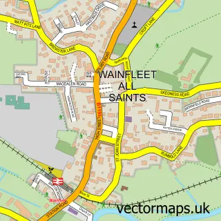
Nearby street map samples around Seacroft

More street maps in Lincolnshire
750 metre map area coverage
Boundary, postcode and point of interest information for the 750m x 750m rectangle centred on this sample map.
Boundaries containing map centre
Constituency: Boston and Skegness Co Const
County: Lincolnshire County
District: East Lindsey District
Icb: NHS Lincolnshire ICB
Parish: Skegness CP
Police Force: lincolnshire
Postcode District: PE25
Postcode Sector: PE25 3
Ward: Scarbrough & Seacroft Ward
Nearby boundaries intersecting sample
No additional intersecting boundaries found.
Postcode coverage
POI category counts
Hotel: 3
Bar: 1
Building Contractor: 1
Driving School: 1
Engineering Services: 1
Golf Course: 1
Laundromat: 1
Linen: 1
Nursery And Gardening: 1
Physical Therapy: 1
Sample points of interest
- Harvey's Bar & Restaurant
- J A Vickers & Son
- Andy P Driving School
- K A Fear Electrical Contractors
- Seacroft Golf Club
- Crown Hotel
- Hatters Hotel
- The Vine Hotel Skegness
- It's a Pressing Job
- Perfect Blinds of Skegness
- Discount Plants skegness
- Sunil Perera
Create a larger editable map of Seacroft
This sample shows only a 750 metre area. To create a larger map of Seacroft, use our map builder to choose your own coverage area, add titles and download editable SVG, PDF and PNG files.
Create a custom map of Seacroft