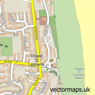
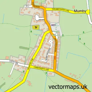
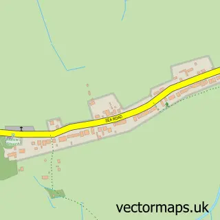
This Ingoldmells street map is a detailed vector street map covering a 750m x 750m area. Select a larger area to create and download your own vector street map of Ingoldmells.
The 750-metre map sample for Ingoldmells covers 291 mapped buildings and approximately 16.7 km of road detail, of which 21 named roads are named. The immediate area includes 1 school and 3 pubs. The wider area around Ingoldmells features 3 tourism points of interest, 10 food and drink venues and 6 hotels. To create a larger or custom map of Ingoldmells, the map builder lets you define your own coverage area and download editable SVG, PDF and PNG files.
Create a larger editable map of Ingoldmells
Choose any area you need and generate a high-quality vector map instantly. Perfect for print, planning, design, business and personal use.

This Ingoldmells street map in Lincolnshire is available as downloadable SVG, PDF and PNG map files, or as a printed map for planning, business, display, education, local information and design work. You can also create a larger custom map area using the map selector.
What this Ingoldmells map sample shows
Ingoldmells lies within Ingoldmells Cp parish, part of Ingoldmells ward in the East Lindsey District local authority area. The postcode geography for this area includes the PE postcode area, the PE25 postcode district and the PE25 1 postcode sector. Residents fall under the Nhs Lincolnshire Integrated Care Board for NHS services.
Local features near Ingoldmells
Within 2 milesAmenities and services in and around Ingoldmells.
Administrative and postcode information for Ingoldmells
The local authority covering Ingoldmells is East Lindsey District, within the county of Lincolnshire. The settlement lies within Ingoldmells ward and Ingoldmells Cp civil parish. The PE25 postcode district and PE25 1 postcode sector serve the immediate area. NHS provision in the area is delivered through United Lincolnshire Hospitals Nhs Trust.
Nearby street map samples around Ingoldmells

More street maps in Lincolnshire
750 metre map area coverage
Boundary, postcode and point of interest information for the 750m x 750m rectangle centred on this sample map.
Boundaries containing map centre
Constituency: Boston and Skegness Co Const
County: Lincolnshire County
District: East Lindsey District
Icb: NHS Lincolnshire ICB
Parish: Ingoldmells CP
Police Force: lincolnshire
Postcode District: PE25
Postcode Sector: PE25 1
Ward: Ingoldmells Ward
Nearby boundaries intersecting sample
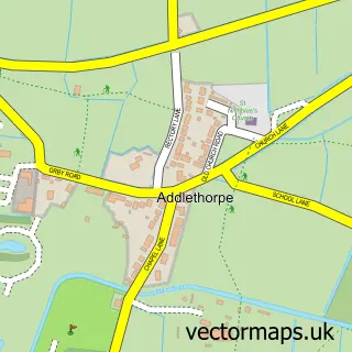
Parish: Addlethorpe CP
Postcode coverage
POI category counts
Hotel: 4
Cafe: 3
Coffee Shop: 3
Pub: 3
Discount Store: 2
Fast Food Restaurant: 2
Liquor Store: 2
Mobile Home Park: 2
Mobility Equipment Services: 2
Park: 2
Sample points of interest
- Ingoldmells
- Greenacres Bar and Restaurant
- Jude's Hair
- Candles restaurant
- Hardys Market
- Taylors Butchers
- Stephils Holidays
- Vincent's Restaurant
- Windsor Cafe
- Ye Old Copper Kettle
- Greenacres Caravan and Camping Site
- Charlie's Den
Create a larger editable map of Ingoldmells
This sample shows only a 750 metre area. To create a larger map of Ingoldmells, use our map builder to choose your own coverage area, add titles and download editable SVG, PDF and PNG files.
Create a custom map of Ingoldmells