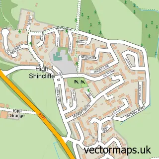
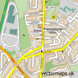
This Shincliffe street map is a detailed vector street map covering a 750m x 750m area. Select a larger area to create and download your own vector street map of Shincliffe.
The 750-metre map sample for Shincliffe covers 109 mapped buildings and approximately 7.7 km of road detail, of which 9 named roads are named. The immediate area includes 4 GP surgeries within 2 miles, 2 pubs and 10 MOT stations within 2 miles. The wider area around Shincliffe features 3 food and drink venues. To create a larger or custom map of Shincliffe, the map builder lets you define your own coverage area and download editable SVG, PDF and PNG files.
Create a larger editable map of Shincliffe
Choose any area you need and generate a high-quality vector map instantly. Perfect for print, planning, design, business and personal use.

This Shincliffe street map in Durham is available as downloadable SVG, PDF and PNG map files, or as a printed map for planning, business, display, education, local information and design work. You can also create a larger custom map area using the map selector.
What this Shincliffe map sample shows
Shincliffe lies within Shincliffe Cp parish, part of Durham South ward in the County Durham local authority area. The postcode geography for this area includes the DH postcode area, the DH1 postcode district and the DH1 2 postcode sector. Residents fall under the Nhs North East And North Cumbria Integrated Care Board for NHS services.
Local features near Shincliffe
Within 2 milesAmenities and services in and around Shincliffe.
Administrative and postcode information for Shincliffe
The local authority covering Shincliffe is County Durham, within the county of Durham. The settlement lies within Durham South ward and Shincliffe Cp civil parish. The DH1 postcode district and DH1 2 postcode sector serve the immediate area. NHS provision in the area is delivered through County Durham And Darlington Nhs Foundation Trust.
Nearby street map samples around Shincliffe

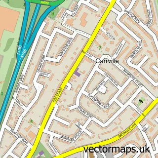
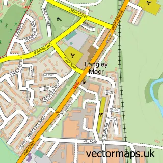
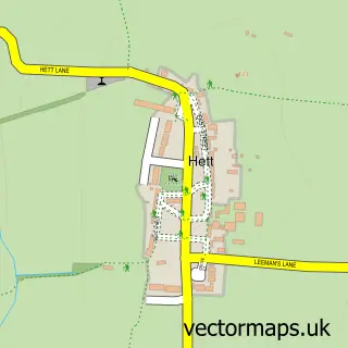
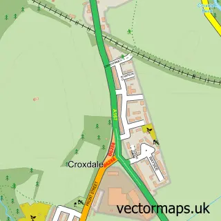
More street maps in Durham
750 metre map area coverage
Boundary, postcode and point of interest information for the 750m x 750m rectangle centred on this sample map.
Boundaries containing map centre
Constituency: City of Durham Co Const
District: County Durham
Icb: NHS North East and North Cumbria ICB
Parish: Shincliffe CP
Police Force: durham
Postcode District: DH1
Postcode Sector: DH1 2
Nearby boundaries intersecting sample
Parish: City of Durham CP
Postcode Sector: DH1 3
Postcode coverage
POI category counts
Flowers And Gifts Shop: 2
Inn: 2
Pub: 2
Anglican Church: 1
Bed And Breakfast: 1
Coffee Shop: 1
Contractor: 1
Discount Store: 1
Holiday Rental Home: 1
Nursery And Gardening: 1
Sample points of interest
- St Mary the Virgin (Shincliffe)
- Seven Stars Inn
- Brambles Coffee Shop
- Geosynthetic Lining Experts
- Poundland
- Norseman Durham
- The Garden Florists
- Unbox Poplar Lodges
- Rose Tree Inn
- Seven Stars Inn
- Poplar Tree Garden Centre and Coffee Shop
- Printright
Create a larger editable map of Shincliffe
This sample shows only a 750 metre area. To create a larger map of Shincliffe, use our map builder to choose your own coverage area, add titles and download editable SVG, PDF and PNG files.
Create a custom map of Shincliffe