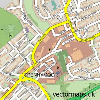
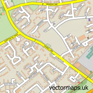
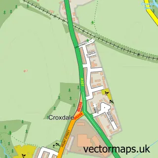
This Langley Moor street map is a detailed vector street map covering a 750m x 750m area. Select a larger area to create and download your own vector street map of Langley Moor.
The 750-metre map sample for Langley Moor covers 317 mapped buildings and approximately 15.6 km of road detail, of which 24 named roads are named. The immediate area includes 3 schools, 1 GP surgery within 2 miles, 1 pub and 4 MOT stations, with 13 within 2 miles. The wider area around Langley Moor features 3 food and drink venues and 2 hotels. To create a larger or custom map of Langley Moor, the map builder lets you define your own coverage area and download editable SVG, PDF and PNG files.
Create a larger editable map of Langley Moor
Choose any area you need and generate a high-quality vector map instantly. Perfect for print, planning, design, business and personal use.

This Langley Moor street map in Durham is available as downloadable SVG, PDF and PNG map files, or as a printed map for planning, business, display, education, local information and design work. You can also create a larger custom map area using the map selector.
What this Langley Moor map sample shows
Langley Moor lies within Brandon And Byshottles Cp parish, part of Brandon ward in the County Durham local authority area. The postcode geography for this area includes the DH postcode area, the DH7 postcode district and the DH7 8 postcode sector. Residents fall under the Nhs North East And North Cumbria Integrated Care Board for NHS services.
Local features near Langley Moor
Within 2 milesAmenities and services in and around Langley Moor.
Administrative and postcode information for Langley Moor
Langley Moor lies within Brandon And Byshottles Cp parish, part of Brandon ward in the County Durham local authority area. The postcode geography for this area includes the DH postcode area, the DH7 postcode district and the DH7 8 postcode sector. Residents fall under the Nhs North East And North Cumbria Integrated Care Board for NHS services.
Nearby street map samples around Langley Moor

More street maps in Durham
750 metre map area coverage
Boundary, postcode and point of interest information for the 750m x 750m rectangle centred on this sample map.
Boundaries containing map centre
Constituency: City of Durham Co Const
District: County Durham
Icb: NHS North East and North Cumbria ICB
Parish: Brandon and Byshottles CP
Police Force: durham
Postcode District: DH7
Postcode Sector: DH7 8
Nearby boundaries intersecting sample
Parish: City of Durham CP
Postcode District: DH1
Postcode Sector: DH1 3
Postcode coverage
POI category counts
Automotive Repair: 6
Beauty Salon: 6
Hair Salon: 6
Contractor: 4
Supermarket: 4
Antique Store: 3
Barber: 3
Beauty And Spa: 3
Bridal Shop: 3
Business Management Services: 3
Sample points of interest
- Belong Creative
- KS Digital
- Rspca Charity Shop
- Amazing Antiques Etc.
- Capercaillie
- St Cuthberts Hospice
- Fenwick Keith
- Keith Fenwick Electrics
- Scrapbook Shop
- JFT Fabrications
- CGSHydrographics
- IH Automotive
Create a larger editable map of Langley Moor
This sample shows only a 750 metre area. To create a larger map of Langley Moor, use our map builder to choose your own coverage area, add titles and download editable SVG, PDF and PNG files.
Create a custom map of Langley Moor